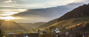
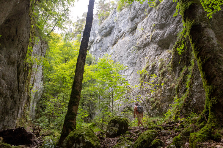
Navigating the Swiss Parks Website
i

Wolfsschlucht-Weg

Hiking trail
Time required: 4 hours 45 minutesLength: 13.00 km

Season

All season

Contact

Naturpark Thal
Hölzlistrasse 57
4710 Balsthal
Tel. +41 62 386 12 30

www.naturparkthal.ch

Naturpark Thal - This tour reveals the different aspects of the Thal Nature Park. From Welschenrohr, the route leads to the beautiful and wildly romantic Wolf Gorge, through which you ascend to continue hiking in the lofty heights of the second Jura chain.

The starting point for this walking is in the village of Welschenrohr. The Wolf Gorge is a cantonal forest reserve and demonstrates the tremendous powers of Mother Nature. Between high and partially over-hanging rocky cliffs, the trail winds upwards through the narrow, wildly romantic gorge with its caves and erosions.

At the end of the climb, you leave the Wolf Gorge through a narrow passage. Continuing over lush Jura pastures, the trail goes via Tannmatt to Mieschegg and then to Hinter Brandberg. The view of the other side of the valley offers tantalising glimpses of one of the largest uninterrupted woodland regions of Switzerland. Dropping down to Welschenrohr, the route passes through a lynx reserve.

Route-information

Route-information

Length
13.00 km
Altitude difference ascent
860 m
Altitude difference descent
860 m
Time required
4 hours 45 minutes
Level technique
Middle
Level condition
Middle
Height profile view map

Details

We recommend getting to Wolfsschlucht by public transport. The Herbetswil Wolfsschlucht bus stop is located directly at the entrance.
In the village centre of Herbetswil there are signposted parking spaces. From there the path to the Wolfschlucht is also marked.
Further parking facilities are available in Welschenrohr.
The Wolfschlucht is a cantonal nature reserve. Please observe the cantonal regulations (regarding fire, dogs. . . ) and the corresponding markings on site.
In wet weather, very good footwear is recommended, as it can be slippery.

Signalization

100 meters below the “Wolfschlucht” bus stop, follow the sign to “Obere Tannmatt”. In Obere Tannmatt, follow the sign to Hinter Brandberg. From there, continue in the direction of “Lochboden” until you reach Lochboden.

Infrastructure

  • Picnicplace
  • Fireplace

Arrival

Starting point
Welschenrohr (Altitude: 687 m)
Arrival by public transport
Welschenrohr, Zentrum Timetable SBB
Destination
Welschenrohr (Altitude: 687 m)
Arrival by public transport
Welschenrohr, Zentrum Timetable SBB

Suitable for

The offer is suitable for

  • Adults
  • Children from 7-12 years
  • Children >12 years
  • 50+
  • Families

Discovering underway

Naturpark Thal

Wolfsschlucht

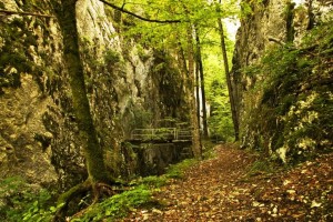
Wolfsschlucht (gorge of the wolf) is a cantonal nature reserve and demonstrates here the enormous power of nature. A trial runs between the steep and overhanging cliffs through the narrow and wild romantic gorge with caves and erosions.

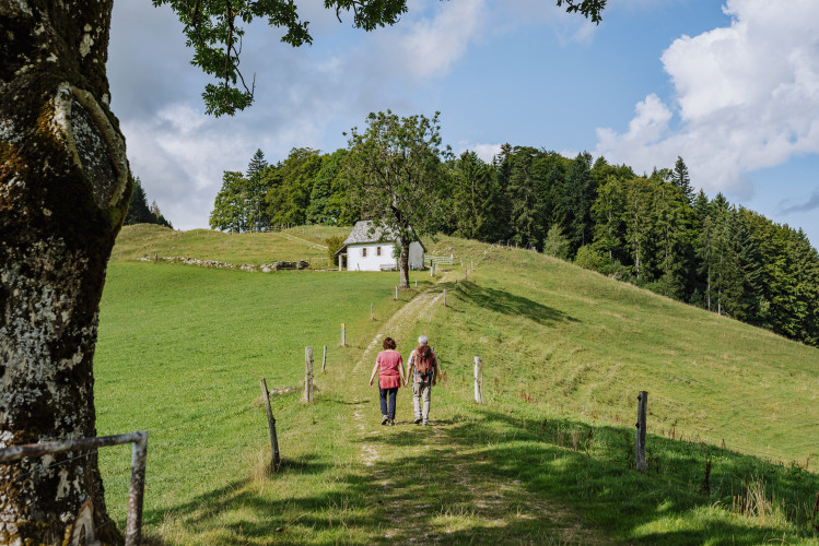
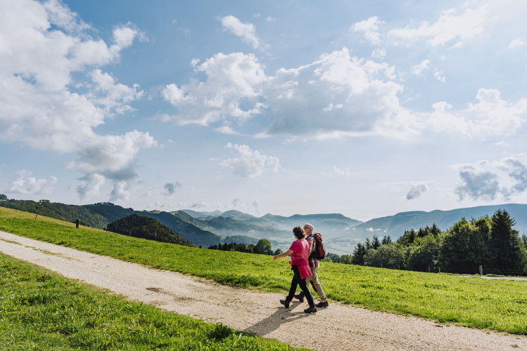
Natural landscape / HabitatWaters
Naturpark Thal

Bergwirtschaft Obere Tannmatt

Visit the Bergwirtschaft after hiking to the Wolfsschlucht

Farm restaurant
Naturpark Thal

Gasthof Kreuz - Welschenrohr

The Gasthof Kreuz is run by the fourth generation of the Läuffer family. Modern hotel, seasonal menu, new winter garden, plenty of parking spaces, children's playground and much more.

RestaurantHotelCafé

Routes in the vicinity

Schweizerischer Nationalpark

18 Fuorcla Val dal Botsch

Closed

The walk over Fuorcla Val dal Botsch leads from the Pass dal Fuorn region to Val Mingèr, via a 2676 m high pass. It is normally passable from end of June to end of September.

Hiking trail
Time required: 6 hours 45 minutesLength: 17.50km
Schweizerischer Nationalpark

19 Val Mingèr

Closed

The last bear in Switzerland was shot in Val Mingèr in 1904. Unfortunately the Swiss National Park was only founded 10 years later and could not, therefore, offer any refuge for this creature.

Hiking trail
Time required: 2 hours 15 minutesLength: 5.50km
Schweizerischer Nationalpark

20 Mot Tavrü

Closed

Val Tavrü is of historic importance to the National Park. From 1911 to 1936, when the whole valley was part of the Park, it formed the boundary to our vast nature reserve.

Hiking trail
Time required: 2 hours 15 minutesLength: 6.00km
Jurapark Aargau

Flower Walk - Föhrenwälder

Auf diesem Streifzug durch die Pfeifengras-Föhrenwälder im Jurapark Aargau entdecken Sie mit der App Flower Walks die Pflanzenwelt rund um sich.

Theme trailHiking trail
Time required: 1 hour 45 minutesLength: 6.90km
Jurapark Aargau

Flower Walk - Küttiger Wiesenvielfalt

Auf diesem Streifzug durch die Küttiger Wiesenvielfalt im Jurapark Aargau entdecken Sie mit der App Flower Walks die Pflanzenwelt rund um sich.

Theme trailHiking trail
Time required: 1 hour 30 minutesLength: 5.00km
Jurapark Aargau

Historischer Rundweg

Entdecken Sie auf den Verkehrswegen der Vergangenheit, wie Rebberge, Weiden und Wälder miteinander verbunden waren.

Theme trailHiking trail
Time required: 1 hour 20 minutesLength: 3.50km
Jurapark Aargau

Rebberg- und Naturwanderweg (Waldroute)

Offen

Entdecken Sie lebendige Natur in Remigen: Der Themenweg erklärt Flora und Fauna in Rebberg, Wald und Feld.

Theme trailHiking trailObstacle-free route
Time required: 1 hour 50 minutesLength: 6.80km
Jurapark Aargau

Rebberg- und Naturwanderweg (Rebbergroute)

Offen

Entdecken Sie lebendige Natur in Remigen: Der Themenweg erklärt Flora und Fauna in Rebberg, Wald und Feld.

Theme trailHiking trailObstacle-free route
Time required: 1 hour 10 minutesLength: 4.20km

Map