Navigating the Swiss Parks Website
i

Forest of Sounds

Theme trail
Time required: < 2hLength: 1.10 km

Season

All season

Contact

Business is partner of the park
Gästeinformation Viamala
Bodaplatz 4
7435 Splügen
Tel. +41 (0)81 650 90 30

www.viamala.ch

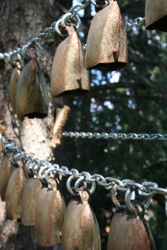
Naturpark Beverin - Near the little mountain village of Lohn, high up on the Schamserberg, you can listen to sounds of all kinds produced by ten very special instruments. Particularly popular with families and children.

At its heart is the elaborate wind harp, emitting magical harmonics to make you really listen and realise that hearing can also mean feeling. The 50 minute walk can be combined with a walk up the Schamserberg.

Route-information

Route-information

Length
1.10 km
Vertical heigth
54 m
Time required
< 2h
Level technique
Easy
Level condition
Easy
Height profile view map

Details

  • child-friendly

Arrival

Starting point
Lohn (Altitude: 1585 m)
Arrival by public transport
Lohn GR, Dorf Timetable SBB
Destination
Lohn (Altitude: 1585 m)
Arrival by public transport
Lohn GR, Dorf Timetable SBB

Suitable for

The offer is suitable for

  • Adults
  • Children < 6 years
  • Children from 7-12 years
  • 50+
  • Families

The offer has been particularly developed for

  • First cycle (Kindergarten and 1st/2nd grade)
  • Second cycle (3rd - 6th grade, primary level)

Discovering underway

Naturpark Beverin

Muntsulej restaurant

The view from the spacious sun terrace towards Avers and the Surettahorn group is also amazing.

RestaurantCafé

Routes in the vicinity

Landschaftspark Binntal

Fäld- Binntalhütte - Fäld

Covered with snow

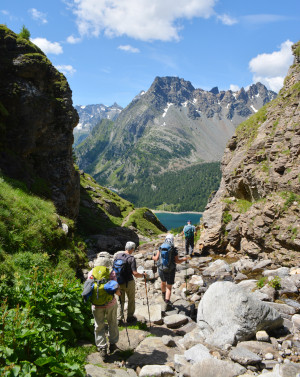
This path is on the old mule-driver route through the Albrun pass, which connects Binntal with the italian valleys of Ossola.

Hiking trail
Time required: 7 hours 30 minutesLength: 16.00km
Naturpark Beverin

Walk to the lake of Libi

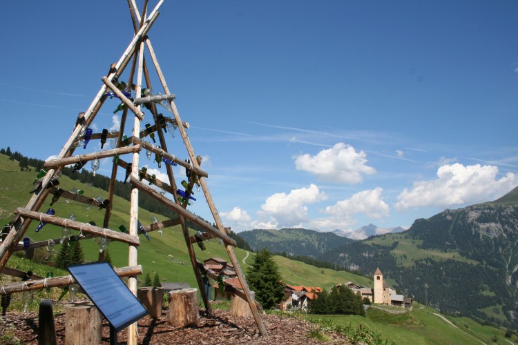
From Mathon over flower meadows to Libi mountain lake. This beautiful lake in the mountain landscape with its barbecue area is the ideal spot for a break. Go down the alpine road to the village of Lohn, where the Echo Forest entices you to visit.

Hiking trail
Time required: 4 hoursLength: 8.00km
Landschaftspark Binntal

Fäld - Manibode - Mässersee - Fäld

Covered with snow

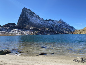
Manibode, Mässerbach and Mässersee and are among the most impressive landscapes in the park.

Hiking trail
Time required: 4 hours 20 minutesLength: 13.00km
Landschaftspark Binntal

Natura Trail

Currently closed

The snow-shoe trail leads from Fäld through semi-open larch woods and over open meadows to the rear of Binntal and then up to Eggerboden and back to Fäld, one of the most beautiful hamlets in the Upper Valais.

Snowshoe route
Time required: 2 hours 50 minutesLength: 5.36km
Landschaftspark Binntal

Sledging in Binntal

Closed

Sledging is a family sport with us. You ride down together through the Binntal/ Eggerbode valley to Fäld.

Sledging trail
Time required: 25 minutesLength: 3.50km
Regionaler Naturpark Schaffhausen

Naturpark-Weinland-Route

This multi-day e-bike and bike route is ideal for nature lovers who enjoy nature.

Bicycle tourE-bike itinerary
Time required: 12 hoursLength: 176.90km
Parc naturel régional Gruyère Pays-d'Enhaut

Charmey – Gruyères

Between nature, culture and heritage

Hiking trail
Time required: 3 hours 15 minutesLength: 11.20km
Landschaftspark Binntal

Fäld-Albrun-Devero-Geisspfad-Fäld

Gesperrt

Zweitageswanderung: Fäld - Binntalhütte - Albrunpass - Alpe Devero und
Alpe Devero - Geisspfad - Fäld

Hiking trail
Time required: 12 hoursLength: 29.00km
Landschaftspark Binntal

Binn – Giessen – Fäld – Binn

Currently closed

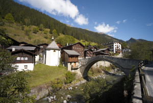
From Binn, you hike to Giessen and then continue to Imfeld. Partly along the asphalt road, you return to Binn.

Hiking trail
Time required: 1 hour 35 minutesLength: 5.73km
Landschaftspark Binntal

Fäld – Figgerscha – Freichi – Brunnebiel – Fäld

Currently not accessible

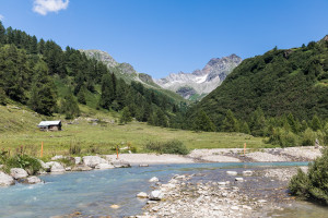
This circular hike takes you from Fäld up to the lush meadows of the Binn Alps on the right, and on the other side of the valley, between partially shady forests, back to Fäld.

Hiking trail
Time required: 2 hours 35 minutesLength: 7.87km

Map