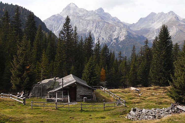
Alp Nursera ad Schwarzwald
Season
June, July, August, September, OctoberNaturpark Beverin - The mountain trail from Ausserferrera to Sufers leads across the Nursera and Schwarzwald Alps with magnificent views of the Hinterrhein valleys of Val Ferrera and Rheinwald, which are characterised by alpine farming and the former mining industry.
The hike begins at the post bus stop in Ausserferrera, lying in the Val Ferrera, with its important mining history. Amongst other things, copper was mined and a mine shaft can be visited with a guide. After crossing the river «Ragna da Ferrera» you immediately start the ascent (530 altimeters, about 1.5 hours) through the Val Nursera in the direction of the alp of the same name.
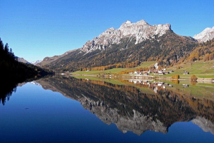
After Alp Nursera the path again climbs up a short distance and at around 2,000 m leads at first towards the Suretta valley. After a short descent to Schwarzwaldalp and another climb (around 200 altimeters), you cross the Suretta valley and reach the «Ross Chopf - horse's head». From here descend through Göriwald to Sufers. Along the way you cross the nascent Hinterrhein and go around half the Sufers reservoir, before reaching your objective, the post bus stop at Sufers. A visit to the alpine dairy is well worthwhile, where there is a wide choice of local cheese specialities.
Route-information
Route-information
- Length
- 11.00 km
- Altitude difference ascent
- 950 m
- Altitude difference descent
- 860 m
- Time required
- 4 hours 30 minutes
- Level technique
- Middle
- Level condition
- Hard
Details
From the post bus Stop Ausserferrera, follow the red and white mountain trail signpost «Alp Nursera» and then the mountain trail signpost «Schwarzwaldalp». After Schwarzwaldalp follow the mountain trail signpost «Ross Chopf», and from point 1710 «Ross Chopf» the mountain trail signposts to Sufers. After crossing the Rhine (where it flows into the Sufner Lake), turn right and follow the yellow hiking trail sign Sufers post bus stop.
Possibilities for catering
Restaurant Seeblick SufersArrival
- Starting point
- Ausserferrera (Altitude: 1301 m)
- Arrival by public transport
- Ferrera, Ausserferrera Timetable SBB
- Destination
- Sufers (Altitude: 1409 m)
- Arrival by public transport
- Sufers Timetable SBB
Suitable for
The offer is suitable for
- Adults
- Children < 6 years
- Children from 7-12 years
- Children >12 years
- 50+
- Families