Navigating the Swiss Parks Website
i

Flurnamenweg

Theme trail
Time required: 2 hours 40 minutesLength: 7.00 km

Season

All season

Contact

Business is partner of the park
Gästeinformation Viamala
Bodaplatz 4
7435 Splügen
Tel. +41 (0)81 650 90 30

www.viamala.ch

Naturpark Beverin - Die Walser haben ihre Spuren auch bei den Tschappiner Flurnamen hinterlassen.
Die Primarschule der Walsergemeinde Tschappina hat entlang einem bestehenden Rundwanderweg 22 Tafeln mit Flurnamenbezeichnungen realisiert.

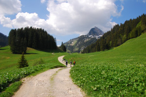
Die 3 1/2-stündige Wanderung beginnt in Untertschappina und führt auf gut markiertem Weg durch lichten Wald ins Nollagebiet und zur ehemals ganzjährig bewohnten Siedlung Masügg.Über Alpweiden gehts nach Ober Masügg und der Ostflanke des Heidbüel entlang zum Glaspass. Der Abstieg führt über den alten Glaserweg zur Kirche von Obertschappina.

Route-information

Route-information

Length
7.00 km
Altitude difference ascent
450 m
Altitude difference descent
660 m
Time required
2 hours 40 minutes
Level technique
Easy
Level condition
Easy
Height profile view map

Details

  • child-friendly

Possibilities for catering

Pension Alpina in Tschappina, Berggasthaus Beverin in Glas

Arrival

Starting point
Untertschappina
Arrival by public transport
Tschappina, Untertschappina Timetable SBB
Destination
Obertschappina
Arrival by public transport
Obertschappina Timetable SBB

Suitable for

The offer is suitable for

  • Adults
  • Children < 6 years
  • Children from 7-12 years
  • Children >12 years
  • 50+
  • Families

The offer has been particularly developed for

  • First cycle (Kindergarten and 1st/2nd grade)
  • Second cycle (3rd - 6th grade, primary level)

Routes in the vicinity

Landschaftspark Binntal

Rhone Route

Open

The cycling route runs between Blitzingen and Grengiols through the Binntal landscape park. The regional nature park is famous for its minerals, flora and intact sites. Niederwald, Mühlebach and Ernen are among the most attractive Valais villages.

Bicycle tour
Time required: 5 hoursLength: 50.00km
Landschaftspark Binntal

Ernen – Galgen – Mühlebach – suspension bridge – Ernen

Open

This walk leads from the old village center of Ernen to the Mosshubel and then to Mühlebach. Via the old village center of Mühlebach and the panoramic trail, you return to Ernen. A detour to the suspension bridge is worthwhile.

Hiking trail
Time required: 1 hour 15 minutesLength: 5.00km
Landschaftspark Binntal

Ernen: Ernen-Z'Brigg

Currently partly closed

The sledging run starts in Ernen village and finishes in Niederernen Z'Brigg. The nearby bus stop offers a good public transport connection.

Sledging trail
Time required: 13 minutesLength: 1.50km
Landschaftspark Binntal

Ernen: Binnegga-Ernen

Currently partially closed

The sledging run starts up in Cholegga and finishes in the historic village of Ernen.

Sledging trail
Time required: 2 hoursLength: 1.50km
Parc naturel régional Gruyère Pays-d'Enhaut

Le Col des Mosses – Rossinière

From the Col des Mosses, the hiking trail cross over streams and through forests to Les Monts Chevreuils. Along the way there are several breathtaking views, such as the Sarine Valley, Château-d’Œx and Les Vanils mountain range.

Hiking trail
Time required: 4 hours 45 minutesLength: 15.50km
Parc naturel régional Gruyère Pays-d'Enhaut

Col des Mosses – La Lécherette

A legacy of the last ice ages.

Hiking trail
Time required: 3 hours 30 minutesLength: 9.80km
Parc naturel régional Gruyère Pays-d'Enhaut

Col des Mosses – Château-d'Œx

Marshy sites and authentic villages.

Hiking trail
Time required: 4 hours 10 minutesLength: 15.20km

Map