Chemin de La Dôle
Hiking trail
Time required: 4 - 6hLength: 14.50 km

Season
All season
Contact
Parc naturel régional Jura VaudoisRte du Marchairuz 2
1188 Saint-George
Tel. +41 22 366 51 70
www.parcjuravaudois.ch
Links
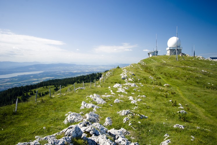
Parc naturel régional Jura vaudois - This hike takes you through lovely meadows and forests up to the Jura’s Dôle Mountain and over to La Givrine.At the summit with a 360° panorama, you will have a breathtaking view of Lake Geneva, Mont Blanc in France and the Jura crest and plateau.
Route-information
Route-information
- Length
- 14.50 km
- Altitude difference ascent
- 860 m
- Altitude difference descent
- 700 m
- Time required
- 4 - 6h
- Level technique
- Easy
- Level condition
- Middle
Height profile view map
Arrival
- Starting point
- Saint-Cergue (Altitude: 1041 m)
- Arrival by public transport
- St-Cergue Timetable SBB
- Destination
- La Givrine (Altitude: 1228 m)
- Arrival by public transport
- La Givrine Timetable SBB
Suitable for
The offer is suitable for
- Adults
- Children from 7-12 years
- Children >12 years
- 50+
- Families
- Groups