Navigating the Swiss Parks Website
i

Franches-Montagnes Tour

Mountainbike trail
Time required: 2 - 4hLength: 42.00 km

Contact

Parc naturel régional du Doubs
6 Place du 23 Juin, CP 316
2350 Saignelégier

www.parcdoubs.ch/

Parc du Doubs - This route provides a gorgeous overview of Les Franches-Montagnes which is a typical Jurassic landscape at 3'280 ft. There are wooded pastures with horses, peatland wilderness areas and fir trees.

The Freiberge hills around Saingnelégier offer Jura landscapes like in a picture book. The idyllic Gruère lake and the border river Doubs are part of the natural resources in the nature park.

Route-information

Route-information

Length
42.00 km
Altitude difference ascent
660 m
Altitude difference descent
660 m
Time required
2 - 4h
Level technique
Middle
Level condition
Middle
Height profile view map

Details

This route is only signposted in one direction: Saignelégier, Les Bois, Le Noirmont, Saignelégier.

Signalization

SwitzerlandMobility Route Nr. 712

Arrival

Starting point
Saignelégier (Altitude: 980 m)
Destination
Saignelégier (Altitude: 980 m)

Suitable for

The offer is suitable for

  • Adults
  • Children from 7-12 years
  • Children >12 years
  • 50+
  • Families

Routes in the vicinity

Parc naturel du Jorat

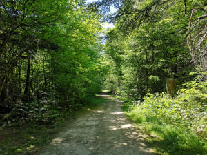
Sentier de l'Etang de la Bressonne

Parcours élaboré par la Ville de Lausanne, depuis le Chalet-à-Gobet et faisant le tours de l'Etang de la Bressonne.

Theme trail
Time required: 30 minutesLength: 1.60km
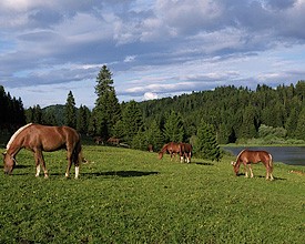
Map