Navigating the Swiss Parks Website
i

Les Bois – Doubs – La Ferrière

Hiking trail
Time required: 4 - 6hLength: 12.00 km

Season

All season

Contact

Parc naturel régional du Doubs
6 Place du 23 Juin, CP 316
2350 Saignelégier

www.parcdoubs.ch/

Parc du Doubs - The walk between Les Bois and La Ferrière offers a magnificent panorama over the Doubs valley, the lake and the gorge in Biaufond (Combe de Biaufond)) and also the little lake of Cul-des-Prés. Pamper yourself with the Jurassic cuisine.

Route-information

Route-information

Length
12.00 km
Altitude difference ascent
445 m
Altitude difference descent
475 m
Time required
4 - 6h
Level technique
Middle
Level condition
Middle
Height profile view map

Details

Points of interest along the route:
1. Freiberg plateau
2. Borne des Trois Evêchés
3. Combe de Biaufond
4. Abraham Gagnebin house

Signalization

From Les Bois, direction Cerneux-Godat and then Biaufond. At the lake, direction combe de Biaufond / Cul-des-Prés. Continue to the direction of La Ferriere.

Safety advices

Bridges and ladders to cross.

Possibilities for catering

Logis de La Licorne, Grand-Rue 17, 2616 La Ferrière. Tél. 032 961 15 55. Tuesday and Wednesday closed

Infrastructure

Benches in Biaufond

Arrival

Starting point
Les Bois, gare
Arrival by public transport
Gare CJ des Bois Timetable SBB
Destination
La Ferrière, gare
Arrival by public transport
Gare CJ La Ferrière Timetable SBB

Suitable for

The offer is suitable for

  • Adults
  • Children >12 years

Routes in the vicinity

Regionaler Naturpark Schaffhausen

Reiatweg

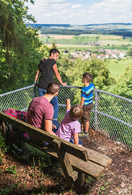
The Reiat trail runs along the typical regional hilly landscape and the four districts of lower Reiat that are well worth seeing. Embark on a special expedition and walk through one of the most northerly regions of Switzerland.

Hiking trail
Time required: 5 hoursLength: 19.00km

Map