Hint

Parc naturel régional Gruyère Pays-d'Enhaut
Application Les Vias du fromage
Avec, plus de 250 curiosités, hôtels, restaurants et magasins de produits du terroir à portée de main, l'application est pratique pour organiser son séjour dans le Parc.
OtherOther
Parc naturel régional Gruyère Pays-d'Enhaut
Around the Lake Lessoc
Open
Follow the historic route of the transport of Gruyère cheese wheels along a path beside the lake, passing over various bridges to arrive in Lessoc, a village whose architecture is marked by the cheese trade.
Theme trail
Time required: 1 hour 40 minutesLength: 6.00km
Parc naturel régional Gruyère Pays-d'Enhaut
Au Pré des Chevaux
Re-connect with nature and heal with horses
Hotel
Parc naturel régional Gruyère Pays-d'Enhaut
Au Soleil de Gruyères
Cute and cosy guest rooms in the heart of the medieval town.
Hotel
Parc naturel régional Gruyère Pays-d'Enhaut
B&B Lever le pied
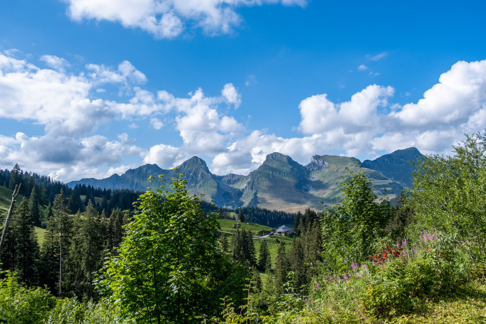
Lever le pied, a suitable programme for this magnificent BnB perched in the Jogne valley above the village of Jaun. The accommodation offers a breathtaking view of the Gastlosen chain and the valley of Jaun.
Hotel
Parc naturel régional Gruyère Pays-d'Enhaut
Bounavau – Charmey
This stage passes through the alpine pastures where Gruyère d'alpage PDO is made. From Tsermon, the magnificent view leads the eye to Lake Geneva. After a quiet descent into the Motélon valley, you reach Charmey via la Monse and then la Tzintre.
Hiking trail
Time required: 6 hoursLength: 15.80km
Parc naturel régional Gruyère Pays-d'Enhaut
Brecca - Chalet du Soldat
After the Breccaschlund, walk along the Euschelspass to Jaun, the only German-speaking village in La Gruyère, and home to a magnificent waterfall, fed by waters from the Vanil Noir. The trail continues on through the breathtaking Gastlosen.
Hiking trail
Time required: 5 hours 40 minutesLength: 15.00km
Parc naturel régional Gruyère Pays-d'Enhaut
Broc - Charmey
This trail, proposed by the Parc Gruyère Pays-d'Enhaut and the communes of Châtel-sur-Montsalvens, Crésuz, Val-de-Charmey and Jaun, showcases the valley's built heritage and living traditions.
Theme trail
Time required: 3 hours 10 minutesLength: 10.80km
Parc naturel régional Gruyère Pays-d'Enhaut
Cabane Des Marindes - Château-d'Œx
Having discovered the kingdom of the golden eagle at the foot of Les Dents des Bimis, the path down to Château-d’Œx takes you past several mountain farms where L’Étivaz AOP cheese is made. A superb panoramic view opens out on to the Pays-d’Enhaut.
Hiking trail
Time required: 3 hours 45 minutesLength: 12.00km
Parc naturel régional Gruyère Pays-d'Enhaut
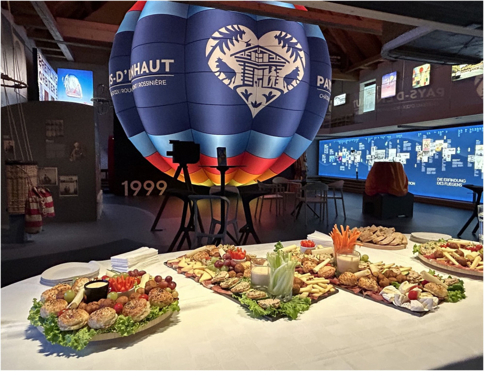
Cap sur le vol en ballon
Plonge dans l'histoire fascinante du vol humain à travers une exposition interactive dédiée aux pionniers de l'aérostation.
Offer for groups
Parc naturel régional Gruyère Pays-d'Enhaut
Cerniat
Cerniat is a typical agricultural mountain village with scattered structures (farms). The village was partially reconstructed at the end of the 19th century : the school and hotel in Heimatstil style (multi-faceted roofs and outdoor mural paintings). The Javroz river flows through the valley which features pastures, forests and several low-land marshes of national importance. For a long time, the forest was the main source of income, its richness evident in Grand Palne-Auta Chia Forest Reserve. Cerniat is an ideal region for hiking and snowshoeing. On the cultural and traditional side, local youth regularly put on plays in the local patois language.
Site
Parc naturel régional Gruyère Pays-d'Enhaut
Chalet du Soldat
Located in the commune of Jaun, the Chalet du Soldat serves as a guesthouse with half-board options and also offers an à la carte menu. Nestled in the heart of a stunning mountain setting, the chalet is accessible on foot during summer.
RestaurantHotel
Parc naturel régional Gruyère Pays-d'Enhaut
Chalet du Soldat – Cabane des Marindes
This stage of the trail offers an array of pre-alpine landscapes through the Petit Mont and Gros Mont valleys. The final ascent takes you through the Vallon des Morteys. The arrival point, the Les Marindes refuge is the ideal spot to observe wildlife
Hiking trail
Time required: 4 hours 30 minutesLength: 12.00km
Parc naturel régional Gruyère Pays-d'Enhaut
Charmey
Nesting in the center of the Jogne valley, Charmey is a subalpine village at about 900 meters elevation. Its population (more than 1800 people) is growing: its location is prized for its high quality of life. Living traditions, beautifully preserved natural landscapes, and sports and cultural activities are abundant. The local economy is tied to agriculture and tourism. On mountaintop pastures and alpine farms, artisan cheese-makers produce Gruyère AOP and Vacherin Fribourgeois AOP during the summer months. The cheeses are then transported to the new Tzintre cheese cellars where they are aged. The village is home to several remarkable buildings, which bore witness to the golden age of alpine economy (16th to 18th century.).
Site
Parc naturel régional Gruyère Pays-d'Enhaut
Charmey - Brecca
This stage of the trail takes in the scenic Breccaschlund (Brecca gorge), home to an incredible variety of wild flora and fauna and offering magnificent views of the surrounding landscapes, some of which appear in the Federal Inventory of Landscapes
Hiking trail
Time required: 5 hours 45 minutesLength: 16.00km
Parc naturel régional Gruyère Pays-d'Enhaut
Charmey - Crésuz
The trail connects the two villages Charmey and Crésuz. It gives the walker a wonderful panorama view of the Jaunbach valley and the valley of Javroz.
Theme trailHiking trailOther routes
Time required: 1 hour 15 minutesLength: 4.30km
Parc naturel régional Gruyère Pays-d'Enhaut
Charmey - Jaun
This trail, proposed by the Parc Gruyère Pays-d'Enhaut and the communes of Châtel-sur-Montsalvens, Crésuz, Val-de-Charmey and Jaun, showcases the valley's built heritage and living traditions.
Theme trail
Time required: 2 hours 50 minutesLength: 11.00km
Parc naturel régional Gruyère Pays-d'Enhaut
Charmey - La Valsainte
Use our new smartphone app to explore the Heritage of the Park.
Theme trailHiking trail
Time required: 1 hour 30 minutesLength: 5.20km

Parc naturel régional Gruyère Pays-d'Enhaut
Charmey milk and cheese dairy
The milk from dairy cows raised on the lush pastures of the Jogne valley is packed full of natural nutrients. So too are the products which are lovingly crafted from it.The Charmey milk and cheese dairy uses this milk in its two flagship products, the incomparable Gruyère and Vacherin Fribourgeois AOP (protected designation of origin). The craftsman behind these cheeses is Sébastien Piller, who took over the dairy in early 2020.All production has been transferred from the original facility in the heart of Charmey village to the La Tzintre cheese dairy. The old Charmey milk and cheese dairy has been renovated and is now home to the Pillers’ shop, which is run by Stéphanie, Sébastien’s wife.Customers can also order cheese platters (with or without cold cuts) from Sébastien and Stéphanie, and hire fondue sets and raclette machines for their special events. The couple hope to launch their online shop in the near future.
Producer
Parc naturel régional Gruyère Pays-d'Enhaut
Charmey – Gruyères
Between nature, culture and heritage
Hiking trail
Time required: 3 hours 15 minutesLength: 11.20km
Parc naturel régional Gruyère Pays-d'Enhaut
Charmey – Schwarzsee Bad
Two sides, two languages
Hiking trail
Time required: 5 hours 50 minutesLength: 16.80km

Parc naturel régional Gruyère Pays-d'Enhaut
Château-d’Œx
Château-d’Œx, with its double calling as a haven of agriculture and tourism, includes the villages and hamlets of Moulins, l’Etivaz, La Lécherette, Gérignoz, and Granges. Architectural gems dot the region: in town a group of marvelous stone buildings constructed after the fire of 1800 and in the rural surroundings superb examples of 17th and 18th century wooden farms. Surrounded by three mountains ranges, the largest municipality in the canton of Vaud is also home to the magnificent Pierreuse Nature Reserve established in 1945 and managed by Pro Natura. The mountainous region gives way to several valleys dominated by high limestone cliffs. The subalpine and alpine vegetation includes remarkable grasslands and marshes.Chateau-d’Œx offers multiple activities to visitors with its various sports facilities (ice-skating rink, bowling alley, gym, sports hall, pool, campground, ski-lifts) and cultural activities (movie theaters and museums).
Site
Parc naturel régional Gruyère Pays-d'Enhaut
Château-d’Œx – Les Moulins
From Château-d'Oex, one proceeds along the railway track and the stream, over meadows and pastures, until the village of Les Moulins is reached, where BIO Gruyère cheese is produced.
Theme trailHiking trailOther routes
Time required: 50 minutesLength: 3.40km
Parc naturel régional Gruyère Pays-d'Enhaut
Château-d’Œx – L’Etivaz
Partially open
This stage of the trail runs along the foot of the Gummfluh and its imposing rocky slopes, through La Pierreuse nature reserve and into the L’Etivaz valley. The trail offers panoramic views that stretch from the Pays-d’Enhaut and the Vaud Alps.
Hiking trail
Time required: 5 hours 30 minutesLength: 13.00km
Parc naturel régional Gruyère Pays-d'Enhaut
Châtel-sur-Montsalvens
In the Jogne valley, at 900 meters altitude, Chatel-sur-Montsalvens enjoys an ideal geographical location, resting on the hillside like a balcony overlooking the valley and man-made lake of the same name. It also has an outstanding view of the Dents Vertes in the direction of Chamey and the Moléson in the direction of Broc. Although agricultural production has been lost in the village, there are still a few typical fribourgeois style farms, now homes and second homes. Along the Cheese Trails toward Gruyères, you can see the ruins of Montsalvens (Broc municipality), a castle dating back to the era of the Counts of Gruyères (13th century).
Site

Parc naturel régional Gruyère Pays-d'Enhaut
Chaudanne Spring
At Chaudanne Spring, water seems to emerge from the depths of the Earth. Water seeps into the ground on the east slope of the Vanils Range and joins an interminable underground network of subterranean galleries, only to reach the surface after travelling several kilometers underground. Located several meters below the main road (Bulle – Château-d’Œx), the spring is circular in form with a diameter of about 2 meters. It spills into a flooded funnel, which marks the entrance to a subterranean water network.The Chaudanne is a vauclusienne spring, which means that its water climbs vertically through pressurized subterranean channels before reaching the surface. Rising from a depth of several hundred meters, this site constitutes one of the deepest submerged galleries in the Prealps. The site is made even more special by the fact that it has been explored by speleologist-scuba divers. In 1988, scuba diver Cyrille Brandt reached the depth of -143 m, which was the deepest speleological
Natural monument
Parc naturel régional Gruyère Pays-d'Enhaut
Col de Jaman
Despite the route's dangers and sometimes questionable condition, this path had two big advantages: it was the shortest route between the Pays-d’Enhaut, the Gruyères, and Léman (Lake Geneva), and it was passable almost year-round. It was also an important gateway for the inhabitants of the high valleys who couldn’t live in complete autarky. In the 19th century, however, the route’s roll changed. Tourists in awe of the panorama (and the echo off the Dent de Jaman) replaced cheese-makers little by little. Tour guides of the time often cited Lord Byron: “This view is as beautiful as a dream!”The pass, impassable by car and still closed to automobile traffic today, can be crossed (other than by foot) thanks to a tunnel built on the MOB (Montreux-Oberland bernois) railway line in 1904. This line remains the main public transportation axis between the Pays-dEnhaut, the Intyamon, and the Lake Geneva region.
Natural monument
Parc naturel régional Gruyère Pays-d'Enhaut
Col des Mosses – Château-d'Œx
Marshy sites and authentic villages.
Hiking trail
Time required: 4 hours 10 minutesLength: 15.20km
Parc naturel régional Gruyère Pays-d'Enhaut
Col des Mosses – La Lécherette
A legacy of the last ice ages.
Hiking trail
Time required: 3 hours 30 minutesLength: 9.80km
Parc naturel régional Gruyère Pays-d'Enhaut
Combes Chapel
Built in 1897, the chapel is an example of neo-gothic architecture. Its decorative murals are of the same origin as it solid oak altar. The Virgin and Child still sit here today, surrounded by Saint Philomène and Saint Elisabeth.
Historical building