Diemtigtal House Trail «Middle of the valley»


Season
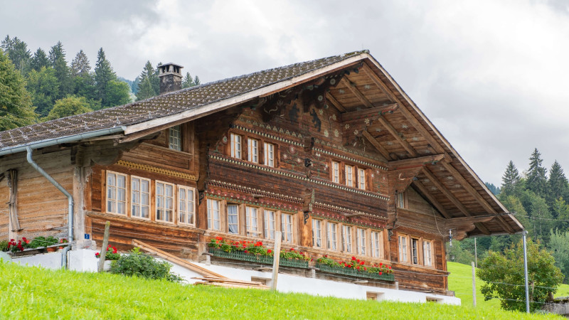
April, Mai, June, July, August, September, OctoberNaturpark Diemtigtal - Thanks to far-sighted local planning, the municipality of Diemtigen has successfully preserved the character of the valley's settlements. «The Middle of the valley» house trail takes you to the most magnificent witnesses in the centre of the valley.
The three house trails lead you to the most magnificent houses.
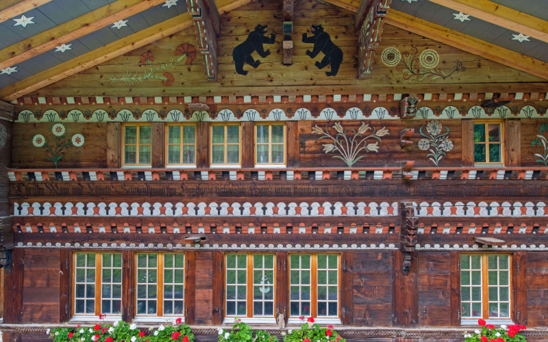
The oldest houses in the Diemtigtal date from the 16th century. However, it is the buildings from the second half of the 18th century and beginning of the 19th century which lend the landscape its special character. The Diemtigtal owes its magnificent buildings to a combination of prosperous farmers and talented craftsmen, including renowned carpenters such as the master carpenter Hans Messerli (1720-1806).
The three house trails «Front of the valley», «Middle of the valley» and «Rear of the valley» show you the most impressive houses and their stories.
Route-information
Route-information
- Length
- 10.20 km
- Altitude difference ascent
- 434 m
- Altitude difference descent
- 434 m
- Time required
- 3 hours 15 minutes
- Level technique
- Easy
- Level condition
- Easy
Details
A flyer with an overview map and information in English about the magnificent buildings is available from the Diemtigtal Nature Park office. You can also find exciting background information on the houses along the trail in our > App.
Naturpark Diemtigtal
Bahnhofstrasse 20
3753 Oey
Phone +41 33 552 26 00
info@diemtigtal.ch
www.diemtigtal.ch
Open or closed?
Find out more in our > summer sports report
- Educational opportunity
Equipment / Equipment rent
Sturdy shoes, clothing appropriate to the weather, food and drinks for the roadSignalization
Follow the Diemtigtal House Trail from the post bus stop «Chirel» in Horboden and cross the road. The trail leads you to the high plateau of Entschwil, where magnificent architecture and a surprising view await you. From here you continue via Riedern, Rothbad to two more impressive buildings in Simmental style at Walkenmatte. Soon you will be descending via Houeten. At Wattfluh you will find the last house of the round tour before returning to the valley road in Horboden. The trail is marked with brown direction signs.If you prefer, you can walk along the valley hiking trail from Horboden to Wampflen in about 45 minutes. Here you will find an old mill, formerly with a bakery. An old millstone in the paving between the residential house and the barn indicates the original function of the house.
Safety advices
The hike leads mainly along side roads (car traffic).Arrival
- Starting point
- Postautohaltestelle «Horboden, Chirel»
- Arrival by public transport
- Horboden, Chirel Timetable SBB
- Destination
- Postautohaltestelle «Horboden, Chirel»
- Arrival by public transport
- Horboden, Chirel Timetable SBB
Suitable for
The offer is suitable for
- Adults
- 50+
- Groups
The offer has been particularly developed for
- Association/Companies