Ponds in the forest of Pfyn
In the heart of the forest of Pfyn/Finges the groundwater forms a series of ponds with resounding names such as: Muggotolo, Pfafforetsee, Muggenseeli, Rosensee and Schafsee.
All season
Naturpark Pfyn-Finges - Open pine forests, picturesque pools and rare flowers
Distance 1.5 km
Time required 0 h 30
Height difference: ascent 50 m
Height difference descent 50 m
Surprise yourself...and experience the unusually high biodiversity in the Pfyn/Finges nature reserve. Picturesque ponds bask in the sun between hills covered in pine trees and offer plants, dragonflies, snakes, frogs and water birds a unique habitat. It is no wonder that this place also inspired people like Rilke, Maurice Chappaz and Corina Bille.
Start at the Ermitage restaurant - follow the sign posts "Rundgang Teiche"
(Restaurant Ermitage is currently closed)
- Restaurant Ermitage and Info pavilion A9
- Parking area at the Ermitage restaurant
(Restaurant Ermitage is currently closed)

In the heart of the forest of Pfyn/Finges the groundwater forms a series of ponds with resounding names such as: Muggotolo, Pfafforetsee, Muggenseeli, Rosensee and Schafsee.

The forest of Pfyn/Finges nature reserve is the centrepiece of the regional nature park Pfyn/Finges. The forest of Pfyn/Finges has been officially protected since 1997, after it had already been included in the KLN inventory in 1963.
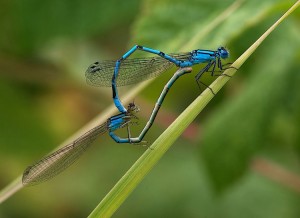
Among all the insects that enliven the ponds and channels in the Pfyn forest, the dragonflies are definitely the most elegant and easiest to observe. There are two types of dragonfly in the forest: The small dragonfly and the large dragonfly.
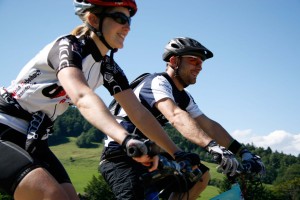
From Balstahl, bike up the Gross Brunnersberg where a stunning view awaits. Continue through the beautiful Guldental valley to Mümliswil. There you'll learn everything you need to know about hairstyles and combs in the HAARUNDKAMM museum.
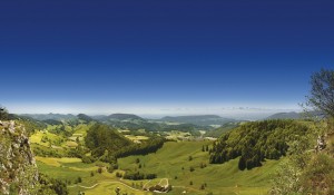
From the Wasserfallen top station you walk to the fantastic viewpoint of Vogelbergfluh and descend to the former comb-making village of Mümliswil. Regional gourmet treats await you in the mountain restaurant and in Mümliswil.
This walk leads from the old village center of Ernen to the Mosshubel and then to Mühlebach. Via the old village center of Mühlebach and the panoramic trail, you return to Ernen. A detour to the suspension bridge is worthwhile.

From Les Brenets, follow the Doubs to the impressive Saut du Doubs, a 27m high waterfall. The river widens into a mineral world to the Châtelot dam before sinking into deep gorges.
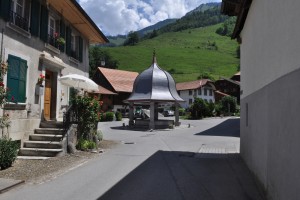
Starting at the Lessoc well (1796), whose cupola was a gift of a cheese merchant from Lyon, the trail leads to Montbovon.

This itinerary follows traces of water starting from Le Locle. The first stage will take you along the French-Swiss boarder across a narrow and wooded valley towards the beautiful Lac des Brenets and then to the blaring Saut du Doubs fall.
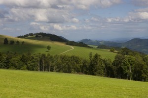
Einzigartiges Wegwandernetz auf der 2. Jurakette. Auf 51 Tafeln erfahren Sie Spannendes über Geografie, Natur und Geschichte im Naturpark Thal.
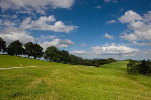
Wandern Sie von Gänsbrunnen nach Balsthal auf der zweiten Jurakette dem Juraweg Thal entlang. Informationstafeln vermitteln Wissenswertes zur Region Thal. Reine Wanderzeit von Gänsbrunnen bis Balsthal oder umgekehrt: 7,5 Stunden.
The perfect Sunday walk – take the NaturparkBus from Balsthal up to the Brunnersberg (1118 m. a. s. l.) From there, you have a gentle hike to the Obere Tannmatt (1122 m. a. s. l.) and take the bus from there back down the valley.
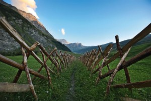
The Safien Walser Trail runs in 3 stages from the Rhine Gorge to the back of the Safien valley. The main direction leads from north to south, into the valley.

From Schaffhausen, the Route Verte takes you to the heart of the Schaffhausen Regional Nature Park and into the "Blauburgunderland". Take a break here to taste their delicious wines.

In the heart of the Thal Nature Park, the forest used as a backdrop to many works of art will enrich your journey. The three mountain passes of this stage offer you breathtaking views.

Auf 6 Tagesetappen den Solothurner und Baselbieter Jura entdecken.
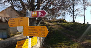
Stage 3, Weissenstein - Balsthal
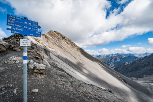
This challenging 8-hour alpine excursion is only recommended for sure-footed walkers with a head for heights.

Comparable to a Swiss Alpine Club mountain hut, Chamanna Cluozza is the only hut within the Park that offers overnight accommodation; with 61 sleeps.
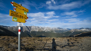
One of the Park’s classics: this is a walk that gives plenty of opportunity to observe animals, many species of flora, and fascinating geological features such as dinosaur tracks or fossilised corals.

Why not go on a journey of discovery in the Naturpark Thal with the little forest sprite.
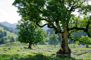
This stage of the trail takes in the scenic Breccaschlund (Brecca gorge), home to an incredible variety of wild flora and fauna and offering magnificent views of the surrounding landscapes, some of which appear in the Federal Inventory of Landscapes
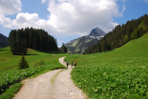
After the Breccaschlund, walk along the Euschelspass to Jaun, the only German-speaking village in La Gruyère, and home to a magnificent waterfall, fed by waters from the Vanil Noir. The trail continues on through the breathtaking Gastlosen.
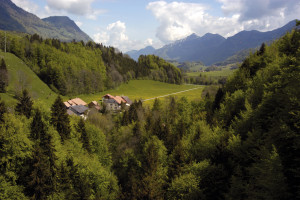
Walk through the undulating, wooded countryside of the Intyamon, with some wonderful features including a covered bridge, the village of Lessoc and its famous fountain, the waterfall and grotto in Grandvillard.
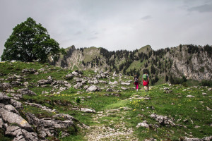
The Three Parks Hike, Stage 5, Schwarzsee-Jaun

A journey through a peaceful valley
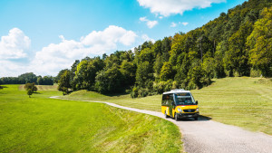
Jeweils am Sonntag mit toller Aussicht vom Brunnersberg zum Passwang wandern und dabei immer wieder an Bergrestaurants vorbeikommen - das ist die NaturparkBus Beizen-Tour.
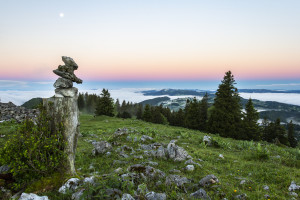
This excursion from the summit of the Chasseral to Chaumont is made for those who prefer the descent to the ascent. You will be taken gently down and up from the mountain peeled by the biting winter to the dense forests of the hillsides.
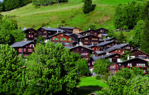
From Mühlebach, you first descend below the road towards Steinhaus. Short sections also need to be covered on the road. Near Steinhaus, a bridge is crossed, and from there, the journey continues to Niederwald.

This hike takes us along the Chapel Trail to Uf en Egga. Enjoy the beautiful panoramic view over the Rhone Valley there. From there, it's all downhill towards Ausserbinn.
To optimise your experience on our website we use cookies. Privacy policy aI agree
