Ze Binne – Wilere – Schmidigehischere
Hiking trail
Time required: 25 minutesLength: 1.00 km

Season
All season
Contact
Tourismusbüro ErnenLandschaftspark Binntal
Hengert 17
3995 Ernen
Tel. +41 27 971 50 55
Landschaftspark Binntal -
Open
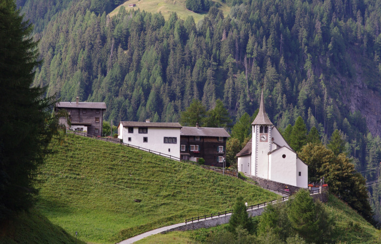
Follow the marked hiking trail "Wilere" in the direction of the church. Once you arrive there, follow the hiking trail in the direction of "ze Binne".The hike begins in "Schmidigehiischere", the main part of Binn. From there you walk to the old church in the hamlet of "Wilere", where you have a wonderful view of the village. You then walk westwards to the hamlet of "Ze Binne" where you can admire the reservoir.
Route-information
Route-information
- Length
- 1.00 km
- Vertical heigth
- 90 m
- Altitude difference ascent
- 100 m
- Altitude difference descent
- 20 m
- Time required
- 25 minutes
Height profile view map
Details
Signalization
YellowPossibilities for catering
Various restaurants in Ze Binne and SchmidigehischereArrival
- Starting point
- Ze Binne (Altitude: 1310 m)
- Arrival by public transport
- Lengtal Timetable SBB
- Destination
- Schmidigehischere (Altitude: 1390 m)
- Arrival by public transport
- Binn, Dorf Timetable SBB
Suitable for
The offer is suitable for
- Adults
- Children < 6 years
- Children from 7-12 years
- Children >12 years
- 50+
- Families
- Groups