Z’Brigg – Niederernen (circular route)
Hiking trail
Time required: 50 minutesLength: 2.50 km

Season
All season
Contact
Tourismusbüro ErnenLandschaftspark Binntal
Hengert 17
3995 Ernen
Tel. +41 27 971 50 55
Landschaftspark Binntal -
Open
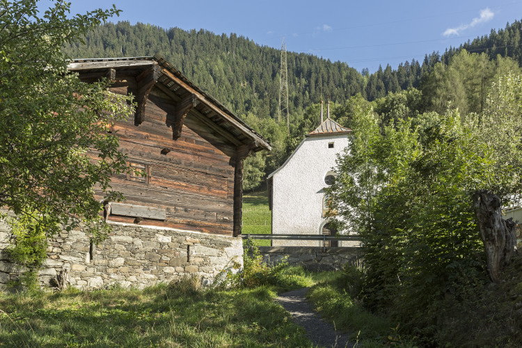
The Z'Brigg group of buildings takes its name from the river crossing. The once important settlement on the Rottenbrücke is now reduced to a few buildings.The circular route begins at the Ernen, Z'Brigg postbus stop. After a short stretch on the motorway towards Ernen, the path climbs to the right up to the Bruder Klaus chapel. Back on the farm track, turn left in an easterly direction towards Niederernen. On the other side of the road by the chapel, the path begins along the Wüer waterway back to Z'Brigg.
Route-information
Route-information
- Length
- 2.50 km
- Vertical heigth
- 150 m
- Altitude difference ascent
- 150 m
- Altitude difference descent
- 150 m
- Time required
- 50 minutes
Height profile view map
Details
Signalization
YellowPossibilities for catering
Restaurant GommerstubaArrival
- Starting point
- Niederernen (Altitude: 1064 m)
- Arrival by public transport
- Niederernen Timetable SBB
- Destination
- Niederernen (Altitude: 1064 m)
- Arrival by public transport
- Niederernen Timetable SBB
Suitable for
The offer is suitable for
- Adults
- Children < 6 years
- Children from 7-12 years
- Children >12 years
- 50+
- Families
- Groups