Talwanderweg (valley hiking trail)


Season
April, Mai, June, July, August, September, October, NovemberLinks
Naturpark Diemtigtal - «There exist several valley hiking trails. However, the Diemtigtaler Talwanderweg [Diemtigtal valley hiking trail] from Schwenden to Oey is unique and deserves the highest commendation.» Translated quote from Wanderführer der Berner Wanderwege (hiking guidebook of Bernese hiking trails, available in German only).
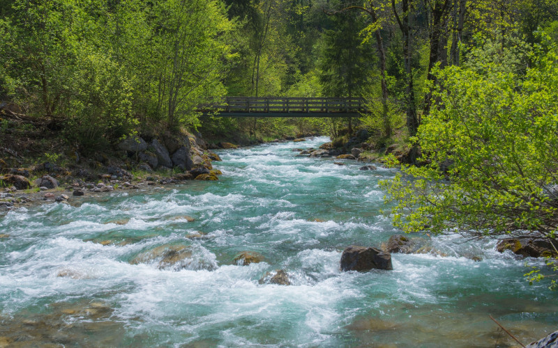
The trail follows the valley streams Fildrich and Chirel and leads you through forests and meadows. It leads alternately alongside flower-filled meadows and through cool, shady forest – most pleasant on hot summer days. Enjoy the sound of rushing torrents as you cross the rivers’ eleven bridges. Rest on one of the numerous benches and cook lunch on one of the barbecue sites along the way.
On this hike, you’re away from the road, but along the 15 km hike you will still find eleven PostBus stops. This means there’s one every 20-40 minutes. There are shortcuts, please check the time schedule of the PostBus.
Route-information
Route-information
- Length
- 15.02 km
- Altitude difference ascent
- 140 m
- Altitude difference descent
- 700 m
- Time required
- 4 hours
- Level technique
- Easy
- Level condition
- Middle
Details
Maps of the Diemtigtal (Diemtig valley) are available at the Diemtigtal Nature Park tourist office.
Diemtigtal Nature Park
Bahnhofstrasse 20
3753 Oey
Phone +41 33 552 26 00
info@diemtigtal.ch
www.diemtigtal.ch
Open or closed?
Find full details in our > summer sport report
Equipment / Equipment rent
Good shoes, enough food and drinks for the hikeSignalization
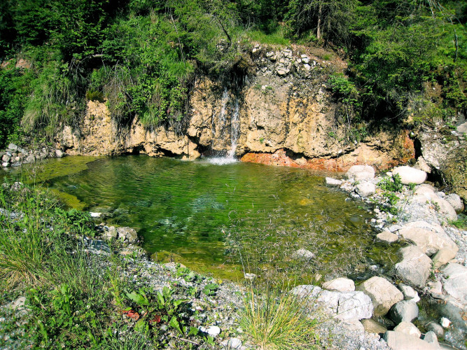
Shortly after the starting point Senggiweid you’ll find the idyllic Blauseeli mountain lake, with its fascinating deep blue colour. Take a rest on one of the numerous benches. The trail leads you along the Senggibach (Senggi stream) to the Schulhaus Schwenden (school). Cross the wide Seeboden area in order to reach the Gwunderwasser water playground below Tiermatti. After crossing the streams twice you’ll reach the Viehschauplatz Anger (place for livestock showing Anger). There’s also a log cabin with a barbecue site offering shelter and seating. If you are hiking with a group, you can reserve the cabin log in advance at the Diemtigtal Nature Park tourist office.The remainder of the path leads mainly alongside the cool forest and the banks of the Fildrich stream. If the Wiriehornbahnen (Wiriehorn chairlift) are operating and you have enough time, take a detour and go up to Nüegg, the mountain station of the chairlift. From there you can enjoy a thrilling descent by scooter back to the valley. The valley hiking trail leads you over undulating ground to the Wampflensagi (Wampflen sawmill) where there’s another barbecue site. The descent before Horboden requires you to be a little bit sure-footed. The last section of the trail, before Oey, impressively shows the force of water. Locals have learned from the last flood and leave a lot of space for the Chirel stream. Just before it you pass the Katzenloch (cat’s hole). There’s another barbecue site with a weather shelter which can be booked at the Diemtigtal Nature Park tourist office.
Safety advices
The hike itself is not demanding, but its length should not be underestimated.Arrival
- Starting point
- Senggiweid (Grimmialp), Schwenden
- Arrival by public transport
- Schwenden i.D., Grimmialp Timetable SBB
- Destination
- Marktplatz, Oey
- Arrival by public transport
- Oey-Diemtigen, Bahnhof Timetable SBB
Suitable for
The offer is suitable for
- Adults
- Children >12 years
- 50+
- Groups