Gros Mont - Abländschen
Season
Mai, June, July, August, SeptemberContact
Parc naturel régional Gruyère Pays-d'EnhautPlace du Village 6
1660 Château-d'Œx
Tel. +41 (0) 848 110 888
gruyerepaysdenhaut.ch
Parc naturel régional Gruyère Pays-d'Enhaut -
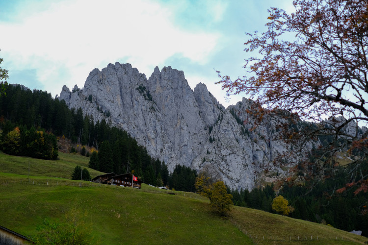
Starting from the Gros Mont car park, the route begins with an ascent to the Gueyre mountain pasture at 1723m. This is followed by a descent to the Petit Mont, which runs alongside the Lapé primary forest, a chaos of boulders created by a rocky collapse at the foot of the majestic north faces of the Dent de Savigny and the Dent de Ruth. Traces of Mesolithic hunter-gatherers (9,500 to 5,000 BC) have been found in the shelter of these stone giants, the largest of which is 40m long! A direct ascent to the Col du Loup takes us to the Bernese side of the mountain. The descent along the southern slopes of the Sattelspitzen is less severe and takes us directly to the village of Abländschen, where you can enjoy a meal at the Zur Sau mountain hotel or the Zittbödeli restaurant. The new Saanen - Mittelberg - Jaun postbus service will then take you comfortably back home.
Route-information
Route-information
- Length
- 10.70 km
- Altitude difference ascent
- 825 m
- Altitude difference descent
- 633 m
- Time required
- 4 hours 20 minutes
Arrival
- Starting point
- Charmey
- Arrival by public transport
- Charmey, Gros Mont Timetable SBB
- Destination
- Abländschen
- Arrival by public transport
- Abländschen, Hubel Timetable SBB
Suitable for
The offer is suitable for
- Adults
- Children >12 years
- 50+
- Families