Navigating the Swiss Parks Website
Map
i

Passwang: Die grüne Route

Hiking trail
Time required: 1 hour 10 minutesLength: 3.70 km

Season

All season

Contact

Business is partner of the park
Naturpark Thal
Hölzlistrasse 57
4710 Balsthal
Tel. +41 (0)62 386 12 30
Fax +41 (0) 62 391 06 22

www.naturparkthal.ch

Naturpark Thal - Kurzer Ausflug rauf und runter

Der Weg führt hoch zum Aussichtspunkt Vogelberg und wieder zurück. Das letzte Stück des Weges geht über den Grat und bietet atemberaubende Weitsicht. Unterwegs liegt die Bergwirtschaft Ober Passwang.

Route-information

Route-information

Length
3.70 km
Vertical heigth
217 m
Time required
1 hour 10 minutes
Level technique
Middle
Level condition
Middle
Height profile view map

Arrival

Starting point
Passwang Parkplatz (Altitude: 992 m)
Arrival by public transport
Passwang Timetable SBB
Destination
Passwang Parkplatz (Altitude: 992 m)
Arrival by public transport
Passwang Timetable SBB

Suitable for

The offer is suitable for

  • Adults
  • Children >12 years
  • 50+
  • Families
  • Groups

Discovering underway

Naturpark Thal

Vogelbergfluh (1204 m.)

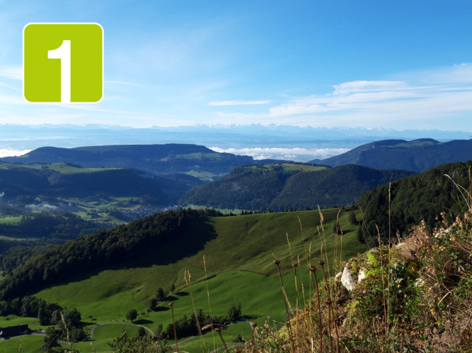
The Vogelbergfluh is probably one of the most beautiful viewpoints in the whole of the Jura. It can be reached either from Wasserfallen top station or from the Passwang mountain road and presents a magnificent 360-degree panorama.

Viewpoint
Naturpark Thal

Bergwirtschaft Ober Passwang

Mit unserer kalten Bergwirtschafts-Küche bieten wir an den Wochenenden eine kleine Stärkung für Wanderer, Ausflügler und weitere Besucher an.

Farm restaurant

Map