Summit hike Mäggisserhore
Season
June, July, August, September, OctoberLinks
Naturpark Diemtigtal - From Springenboden to Mäggisserhore: discover a true hiking gem on the Niesen chain
The impressive hike with the destination «peak of the Mäggisserhore» starts at the «Hasenloch» car park in Horboden. If you travel by public transport, the starting point can be reached on foot from the PostBus stop «Horboden, Chirel» in approx. 1 h 30 min. Although the hike begins on an asphalt road, the higher you climb, the more it unfolds as a true hiking gem.
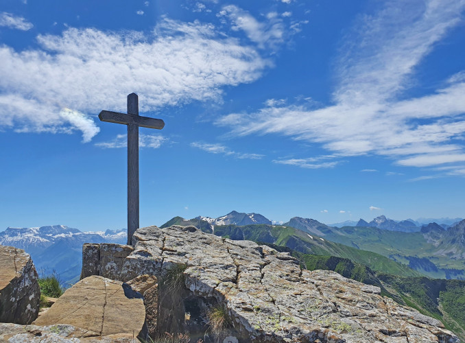
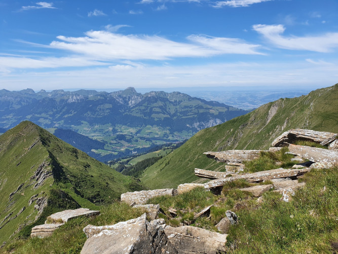
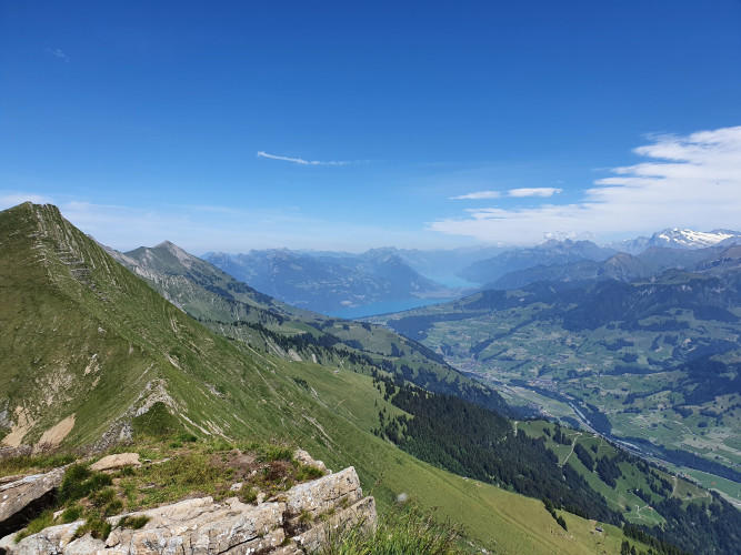
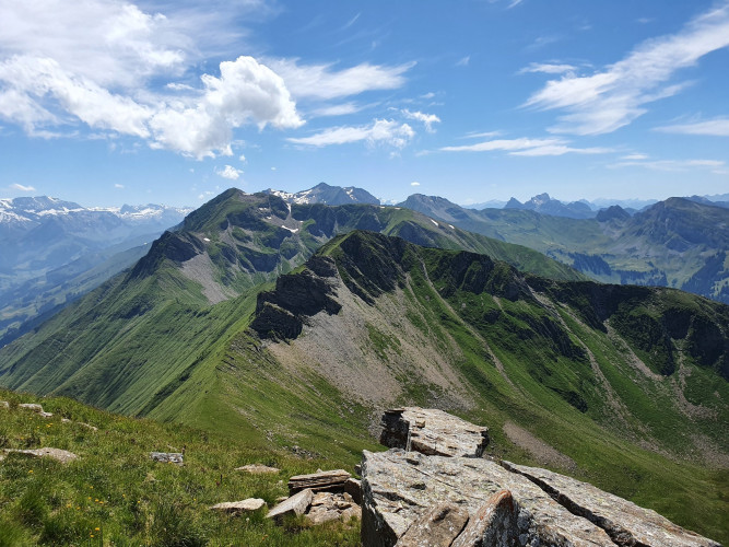
From the alp «Hore», a steep dirt road leads to the alp «Ober Mechlistall». Past the picturesque lake «Mechlistallseeli», a clearly visible hiking trail leads further and further up to the summit of the Mäggisserhore. At the top, you have a breathtaking view of the Diemtigtal Nature Park, the Simmen and Kander valleys, Lake Thun and Lake Brienz and the neighbouring Alpine peaks of the Bernese Oberland, which seem close enough to touch from up here.
Route-information
Route-information
- Length
- 13.69 km
- Altitude difference ascent
- 1062 m
- Altitude difference descent
- 1062 m
- Time required
- 5 hours
- Level technique
- Easy
- Level condition
- Middle
Details
A hiking map is available from the Diemtigtal Nature Park office.
Diemtigtal Nature Park
Bahnhofstrasse 20
3753 Oey
Phone 0041 33 552 26 00
info@diemtigtal.ch
www.diemtigtal.ch
Equipment / Equipment rent
Good mountain boots, clothing appropriate to the weather (sun/rain protection), possibly walking sticks, pocket pharmacy, rucksack with food and enough drinks for the journeySignalization
From the «Haseloch» car park, follow the road on foot, which leads up to the right to Springenboden and then straight on along the only asphalt road to the «Bärgli» alp. Here follow the road to the right in the direction of «Widbodmen» and «Hore». From the alp «Hore», a steep dirt road leads you in the direction of the alp «Mechlistall». Follow the natural road until you reach the alp «Oberer Mechlistall». From here, a narrow hiking trail leads past the Mechlistallsee lake directly to the summit of the Mäggisserhore.Safety advices
Your hike takes you through a variety of pastures - always keep your distance from the four-legged alpine inhabitants. Especially on the last section of the hike you need a little head for heights.Arrival
- Starting point
- Parkplatz «Hasenloch», Springenboden
- Destination
- Parkplatz «Hasenloch», Springenboden
Suitable for
The offer is suitable for
- Adults
- Children >12 years
- 50+