Pass hike Scheidegg


Season
June, July, August, September, OctoberLinks
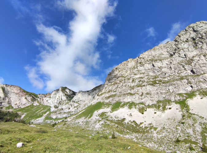
Naturpark Diemtigtal - The hike connects the Diemtigtal Nature Park with the municipality of Zweisimmen. On the Scheidegg, an unexpectedly wild mountain world awaits you at the foot of the Spillgerten.
Your pass hike starts at the very back of the Diemtigtal Nature Park and with it the ascent to "Scheidegg", where the two municipalities of Diemtigen and Zweisimmen meet. Rock deer and eagles feel particularly at home in the "Alpetli": with a bit of luck, you can observe the shy mountain dwellers in their natural environment with binoculars. On the "Scheidegg", the highest point of your hike, you can enjoy a stay in a wild, barren mountain world and perhaps even discover a marmot or two. From here, the varied descent begins across alpine meadows, through forests and along mountain streams to Blankenburg.
Route-information
Route-information
- Length
- 13.55 km
- Altitude difference ascent
- 823 m
- Altitude difference descent
- 1095 m
- Time required
- 5 hours
- Level technique
- Easy
- Level condition
- Middle
Details
A hiking map is available from the Diemtigtal Nature Park office.
Diemtigtal Nature Park
Bahnhofstrasse 20
3753 Oey
Phone 0041 33 552 26 00
info@diemtigtal.ch
www.diemtigtal.ch
Equipment / Equipment rent
Good mountain boots, clothing appropriate to the weather (sun/rain protection), possibly walking sticks, binoculars/field glasses, pocket pharmacy, rucksack with food and sufficient drinks for the journeySignalization
Follow the hiking trail from Senggiweid via Würzi in the direction of Alpetli. The first part of the trail leads along the Grimmimutz adventure trail with its many play posts. From Würzi, the mountain trail winds its way up via Alpetli to the pass Scheidegg. From here the descent begins in the direction of Fromatt. You hike past the Fromatt hut and down into the Fromattchäle. Follow the winding hiking trail until you get closer and closer to your destination via Sitewald/Baawald. When you come out of the forest, you reach Betelriedgasse and encounter the first inhabited houses of Blankenburg. Follow Betelriedgasse to Lenkstrasse, where you cross the main road and follow Bühlmattweg to Blankenburg station. Attention: «Stop on demand» applies here (to make the train stop, press the button on the station building). If you want to hike longer or don't want to wait for the train, you can add another 15 minutes and follow the main road to Zweisimmen.Arrival
- Starting point
- Senggiweid (Grimmialp), Schwenden
- Arrival by public transport
- Schwenden i.D., Grimmialp Timetable SBB
- Destination
- Bahnhof Blankenburg, Zweisimmen
- Arrival by public transport
- Blankenburg Timetable SBB
Suitable for
The offer is suitable for
- Adults
- Children >12 years
- 50+