Pass hike Grimmifurggi


Season
June, July, August, September, OctoberLinks
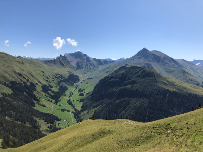
Naturpark Diemtigtal - The hike connects the Diemtigtal Nature Park with the municipality of St. Stephan and offers you beautiful panoramic views over the Diemtigtal and the upper Simmental on the Grimmifurggi.
Your pass hike starts at the very back of the Diemtigal Nature Park and with it the ascent to "Grimmifurggi", where the two municipalities of Diemtigen and St. Stephan meet. This ascent is cause for celebration, because in the "Grimmi" area something not quite ordinary awaits you: the ferruginous source of the Grimmi water stands out amidst alpine meadows and fascinates with its red colour.
On the «Grimmifurggi» you have a panoramic view of the rear Diemtigtal and the upper Simmental and feel surrounded by a multitude of impressive mountain peaks. Directly below you stretches the lonely «Färmeltal» with its wild barrenness - perhaps a suitable destination for your next hike?
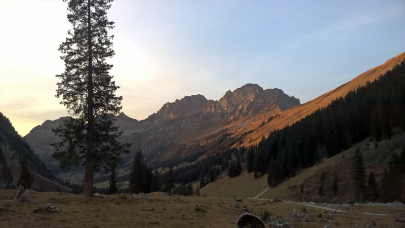
Do you want to cover even more metres in altitude? From Grimmifurggi, the Rauflihore/Bluttlighore (2323 m a.s.l.) can be reached via a grassy ridge in 1 hour 15 minutes (there and back), before you tackle the descent across countless alpine meadows to the Matten railway station (St. Stephan).
Route-information
Route-information
- Length
- 14.03 km
- Altitude difference ascent
- 810 m
- Altitude difference descent
- 1006 m
- Time required
- 5 hours 15 minutes
- Level technique
- Easy
- Level condition
- Middle
Details
A hiking map is available from the Diemtigtal Nature Park office.
Diemtigtal Nature Park
Bahnhofstrasse 20
3753 Oey
Phone 0041 33 552 26 00
info@diemtigtal.ch
www.diemtigtal.ch
Equipment / Equipment rent
Good mountain boots, possibly hiking sticks, clothing appropriate to weather and temperature (sun/rain protection), pocket pharmacy, rucksack with food and enough drinks for the journeySignalization
The ascent begins at the Senggiweid car park, 400 m after the «Grimmialp» PostBus stop and leads initially along the Grimmimutz adventure trail to the «Carve a magic wand» post. Here the trail turns left and winds in many curves through the shady mountain forest up to Alp Grimmi. Shortly after the mountain restaurant on Alp Grimmi, it is worth taking a short detour to the ferruginous spring of Grimmi water before tackling the last part of the ascent to Grimmifurggi. Here you leave the Diemtigtal Nature Park behind you and continue downhill via «Almi» to «Dachboden», from where you can enjoy the last views of the mountain peaks of the upper Simmental. Through the «Höje» forest you then reach the village of Matten and its railway station.Safety advices
Your hike will take you through a variety of pastures - always keep your distance from the four-legged alp inhabitants.Arrival
- Starting point
- Postautohaltestelle «Schwenden i.D., Grimmialp»
- Arrival by public transport
- Schwenden i.D., Grimmialp Timetable SBB
- Destination
- Bahnhof Matten i.S.
- Arrival by public transport
- Matten i.S. Timetable SBB
Suitable for
The offer is suitable for
- Adults
- Children >12 years
- 50+