Steinmatten – Twingischlucht – Ze Binne
Hiking trail
Time required: 1 hourLength: 2.80 km


Season
June, July, August, September, OctoberContact
Tourismusbüro ErnenLandschaftspark Binntal
Hengert 17
3995 Ernen
Tel. +41 27 971 50 55
Landschaftspark Binntal -
Currently closed
Winter closure in the Twingi Gorge
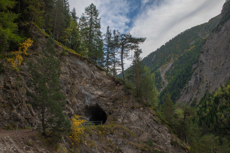
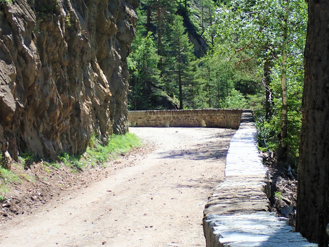
The path through the Twingi Gorge was already used in prehistoric times. It led to the settlement area of the inner Binntal and was a connecting route to the Albrun Pass, an important pass crossing at that time. The pass was not only used for local traffic, but was also an important transit route for trade relations, which were already extensive at the time. In 1964, the Twingi Gorge was bypassed with a tunnel to ensure winter access to the settlements in the Binntal. The hike ends in the small hamlet of Ze Binne.
Route-information
Route-information
- Length
- 2.80 km
- Vertical heigth
- 25 m
- Altitude difference ascent
- 50 m
- Altitude difference descent
- 20 m
- Time required
- 1 hour
Height profile view map
Details
- Suitable for strollers
Signalization
YellowPossibilities for catering
Twingi Stubji, Ze BinneArrival
- Starting point
- Steinmatten (Altitude: 1335 m)
- Arrival by public transport
- Steinmatten Timetable SBB
- Destination
- Ze Binne (Altitude: 1310 m)
- Arrival by public transport
- Lengtal Timetable SBB
Suitable for
The offer is suitable for
- Adults
- Children < 6 years
- Children from 7-12 years
- Children >12 years
- 50+
- Families
- Groups