Obergurnigel Trail (SwitzerlandMobility 114)


Season
January, February, March, DecemberContact
Naturpark GantrischFörderverein Region Gantrisch
Schlossgasse 13
3150 Schwarzenburg
Tel. +41 (0)31 808 00 20
www.gantrisch.ch
Naturpark Gantrisch -
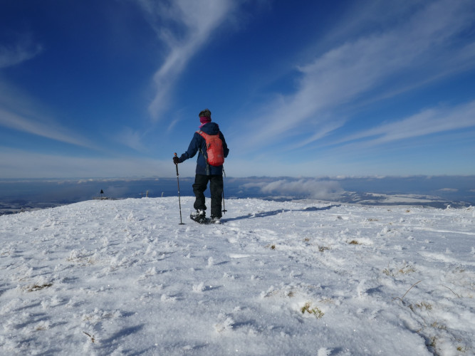
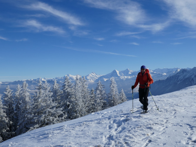
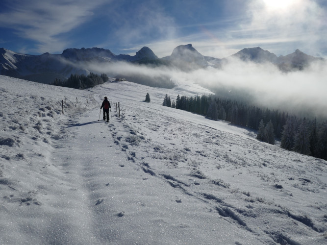
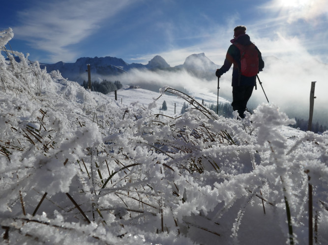
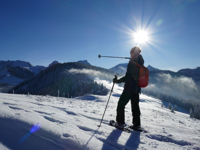
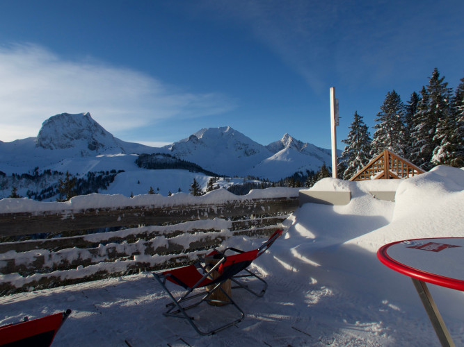
The scenic trail connects the Gurnigelpass with the historic Gurnigelbad. The ridge hike on the Obere Gurnigel offers magnificent distant views in the direction of the Bernese Oberland, the Mittelland and back to the Gantrisch chain.
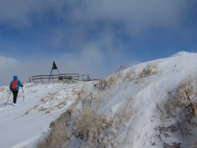
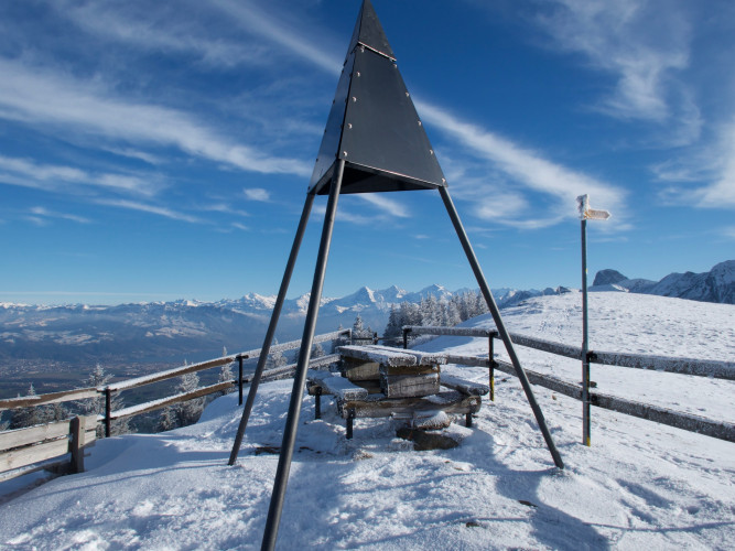
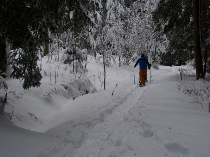
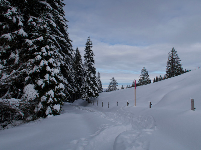
The trail begins at Berghaus Gurnigel on the pass of the same name. First it leads slightly downhill through fir forest to Alp Gurnigelberg. The path is often lined with snow piled up by the west wind. The view opens up more and more towards the east to Lake Thun and the snowy mountains of the Bernese Oberland. The trail now climbs gently over open alpine meadows and follows the ridge to the Obere Gurnigel. At the pyramid-shaped survey signal and the resting benches, the vantage point is reached. The views towards the Gürbetal, the city of Bern, down into the Mittelland and towards the Emmental are impressive. On a clear day, even the highest Jura chains are visible. A special experience awaits the visitor when a fluffy blanket of fog covers the Mittelland and surges like ocean waves against the Ober Gurnigel. Above the wooded hills of the Zigerhubel and Selibühl, the rugged peaks of the Gantrisch chain always remain visible. The way back leads along the same route past the Gurnigel mountain hut. Shortly afterwards, the trail branches off: From the Gurnigelberg, the trail climbs downhill through the forest. Along the summer biker route and then at the edge of the ski slope and the lift line, it ends at the historic Gurnigel Bad. The sulphurous healing water still bubbles out of the fountain in front of the hotel and restaurant, a former outbuilding of the Grand Hotel Gurnigelbad. That is all that remains of the once proud hotel, which attracted noble guests from all over E
Route-information
Route-information
- Length
- 6.48 km
- Altitude difference ascent
- 483 m
- Altitude difference descent
- 46 m
- Time required
- 2 hours 45 minutes
- Level technique
- Easy
- Level condition
- Middle
Details
Equipment / Equipment rent
Materialmiete
- Gurnigel Berghaus, Gurnigel (Selbstbedienung beim Langlaufverleih)
- Schwarzenbühl Kurhaus (Selbstbedienung beim Langlaufverleih)
- Gantrisch Bike & Sport, Riggisberg
Signalization
The trail is a permitted route for winter sports through a cantonal wildlife protection area. Without snowshoes, it is also permitted to follow the hiking trail around the Zigerhubel or to descend directly from the triongulation point on the Oberen Gurnigel to the Gurnigel Bad.
For more information on the wildlife rest areas, visit www.wildruhezonen.ch
or directly the link to the map extract
Arrival
- Starting point
- Berghaus Gurnigel (Höhe: 1593 m)
- Destination
- Gurnigel Bad
Suitable for
The offer is suitable for
- Adults
- Children from 7-12 years
- Children >12 years
- 50+
- Families
- Groups