Navigating the Swiss Parks Website
Map
i

Les Prés-d'Orvin – Chasseral

Hiking trail
Time required: 3 hours 30 minutesLength: 12.00 km

Season

Mai, June, July, August, September, October

Contact

Jura bernois Tourisme
Place de la Gare 2
2610 Saint-Imier
Tel. +41 (0)32 942 39 42

www.grandchasseraltourisme.ch

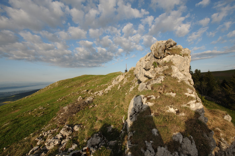
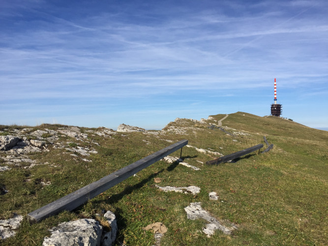
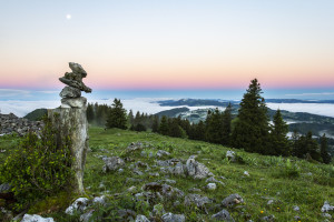
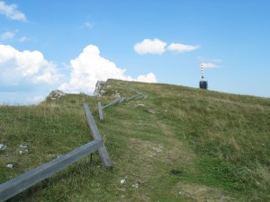
Parc régional Chasseral - A relatively gentle but continuous uphill hike from Les Prés-d'Orvin to the summit of the Chasseral following the ridge and through typical forests and wooded pastures. Panoramic views, alpine flora and the Chasseral antenna are on the menu.

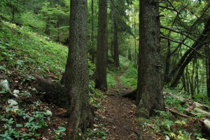
From the bus stop, the route climbs gently towards the "Place Centrale", first on a road and then through forest and wooded pastures.

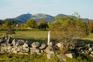
The semi-open pastures of the Chasseral massif and a large part of the geological Jura offer very pleasant landscapes to the eye: neither too closed to give a feeling of oppression, nor too open to limit the feeling of infinity. These wooded pastures, the visual signature of the region, are always the result of human labour.

Over the centuries, agricultural pioneers cleared the forests on the slopes of the massif in order to graze their animals in the cleared areas.

Today, the evolution of agriculture, such as the reduction in the number of heifers being driven into the mountains, is leading to a gradual disappearance of this environment. The forest is gaining ground or, on the contrary, the trees are disappearing little by little. The landscape interest of this environment, shaped by human activity, justifies management measures such as clearing the brush, reopening the woodland or planting young trees.

Route-information

Route-information

Length
12.00 km
Amount untarred route
10.00 km
Vertical heigth
534 m
Altitude difference ascent
730 m
Altitude difference descent
185 m
Time required
3 hours 30 minutes
Level technique
Easy
Level condition
Middle
Height profile view map

Details

Possibilities for catering

Métairie du Bois-Raiguel
Hôtel Chasseral

Infrastructure

  • Playground
  • Picnicplace
  • Fireplace
  • Toilet

Arrival

Starting point
Les Prés-d'Orvin, arrêt de bus "Les Prés-d'Orvin Bellevue".
Accessible depuis la gare de Bienne avec la ligne 70 des Transports publics biennois (TPB) (Altitude: 1014 m)
Arrival by public transport
Les Prés-d'Orvin, Bellevue Timetable SBB
Destination
Hôtel Chasseral. Retour en bus direction Saint-Imier (CJ) ou La Neuveville (Carpostal). Uniquement les weekends et jours fériés. (Altitude: 1548 m)
Arrival by public transport
Chasseral, Hôtel Timetable SBB

Suitable for

The offer is suitable for

  • Adults
  • Children from 7-12 years
  • Children >12 years
  • 50+
  • Groups

Discovering underway

Parc régional Chasseral

Chasseral - Chaumont

This excursion from the summit of the Chasseral to Chaumont is made for those who prefer the descent to the ascent. You will be taken gently down and up from the mountain peeled by the biting winter to the dense forests of the hillsides.

Hiking trail
Time required: 4 hoursLength: 15.00km
Parc régional Chasseral

Chasseral durch die "Combe Biosse"

Gehen Sie durch die wilde «Combe Biosse» im Val de Ruz, unterhalb des Chasseralgrats, um zum Gipfel zu gelangen. Der Abstieg erfolgt durch die Wälder und Weiden des Chasserals.

Hiking trail
Time required: 4 hours 30 minutesLength: 15.00km
Parc régional Chasseral

Trail to Chasseral ridge

Set off to discover the features of this regionthe alpine mountain flora, the limestone and much more, with a wonderful view.

Theme trailHiking trail
Time required: 30 minutesLength: 1.70km
Parc régional Chasseral

Bison Ranch

The Bison Ranch is a unique place in the region... It features a park with real American bison, as well as a restaurant with a Far West atmosphere offering a range of specialities including sausages and terrines made from bison meat. You can also sta...

Alpine huts offering regional product

Routes in the vicinity

Parc régional Chasseral

The farm tour

In the middle of forests and pastures, the walk on the heights of the Prés-d'Orvin allows you to take breaks to taste farm products in about ten establishments.

Hiking trail
Time required: 4 hoursLength: 14.00km

Map