


La Sarine au Pays-d'Enhaut
Parc naturel régional Gruyère Pays-d'Enhaut - From Rougemont, which was once the priory of Cluny, the trial goes over the Kirchenhügel from Château-d'Oex to the Grand Chalet of Rossinière. It goes between the rushing Saane and landscape steeped in history, moulded by the mountain farmers.
The trail starts in Rougemont at the foot of the imposing peak of the Gummfluh. The village has several architectural gems, such as the old timber houses with their richly decorated façades or the priory church, a prominent testimony to the religious heritage of the region.
From Rougemont, the trail follows the course of the River Saane and leads over a track to the waterfall of Ramaclé. After this water meadow zone, Château-d'Œx can be reached by crossing the Turrian bridge, one of the few suspension bridges in West Switzerland. In the middle of the village one can climb up to the Colline du Temple, the Kirchenhügel (Church hill) and enjoy a rewarding view of the old village centre. The trail turns towards La Chaudanne, where the Saane is crossed over the bridge of Grangettes.
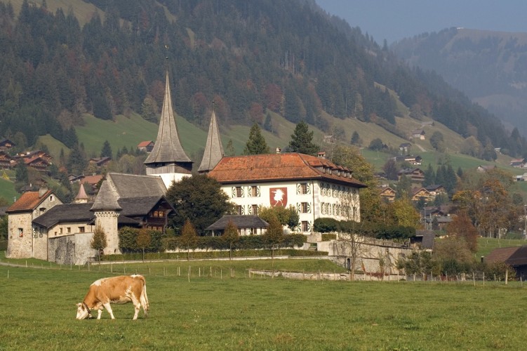
It continues through meadows to Rossinière. The place is renowned for its outstanding timber architecture, particularly the Chalet de la Place and the famous Grand Chalet, where Balthus spent his final yea
Route-information
Route-information
- Length
- 15.00 km
- Altitude difference ascent
- 320 m
- Altitude difference descent
- 460 m
- Time required
- 2 hours
- Level technique
- Easy
- Level condition
- Easy
Details
From the train station of Rougemont-Village, follow the yellow marked trail in the direction of le Crêt. From Le Crêt, go on the direction of Gérignoz and then the direction of Château-d'Œx. From Château-d'Œx, take de direction of La Frasse, and then La Chaudanne. From La Chaudanne, follow the direction of Rossinière up to the village.
- child-friendly
Arrival
Arrival
- Starting point
- Rougemont (Altitude: 991 m)
- Arrival by public transport
- Rougemont Timetable SBB
- Destination
- Rossinière (Altitude: 891 m)
Suitable for
The offer is suitable for
- Adults
- Children < 6 years
- Children from 7-12 years
- Children >12 years
- 50+

Contact
Parc naturel régional Gruyère Pays-d'EnhautPlace du Village 6
1660 Château-d'Œx
Tel. +41 (0) 26 924 23 33
www.gruyerepaysdenhaut.ch