


Flühli - Chessiloch waterfall
UNESCO Biosphäre Entlebuch - Adventurous circular hike to the Chessiloch waterfall and the impressive Chessimätteli suspension bridge - the longest suspension bridge in the UNESCO Biosphere Entlebuch.
The circular route starts in the village of Flühli and first leads on the Kneipp circuit to the natural wellness oasis Schwandalpweiher. Here a small detour to the beautiful facility is worthwhile.
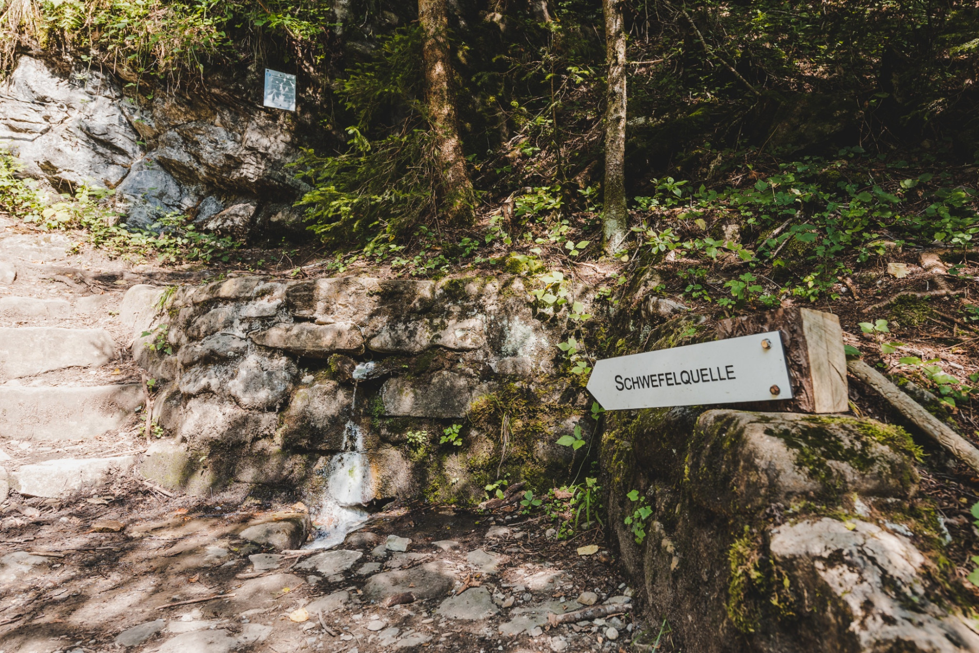
Refreshed, you then head towards Chessiloch. At the former glass hut "Kragen" you enter a pleasantly wide gravel path into the green forest. Wonderful, this natural atmosphere, the birds chirp in competition and on the right the rushing Seebenbach plays its music. After five minutes of walking, a narrow, inconspicuous path branches off to the right, down towards the stream bed, marked with a root-grown signpost "Sulfur spring". The way down to the spring is short but somewhat steep; a handrail helps with climbing down. Now no one may chicken out from drinking a big sip of the healthy sulfur water - if necessary with a pinched nose - which was once considered healing.
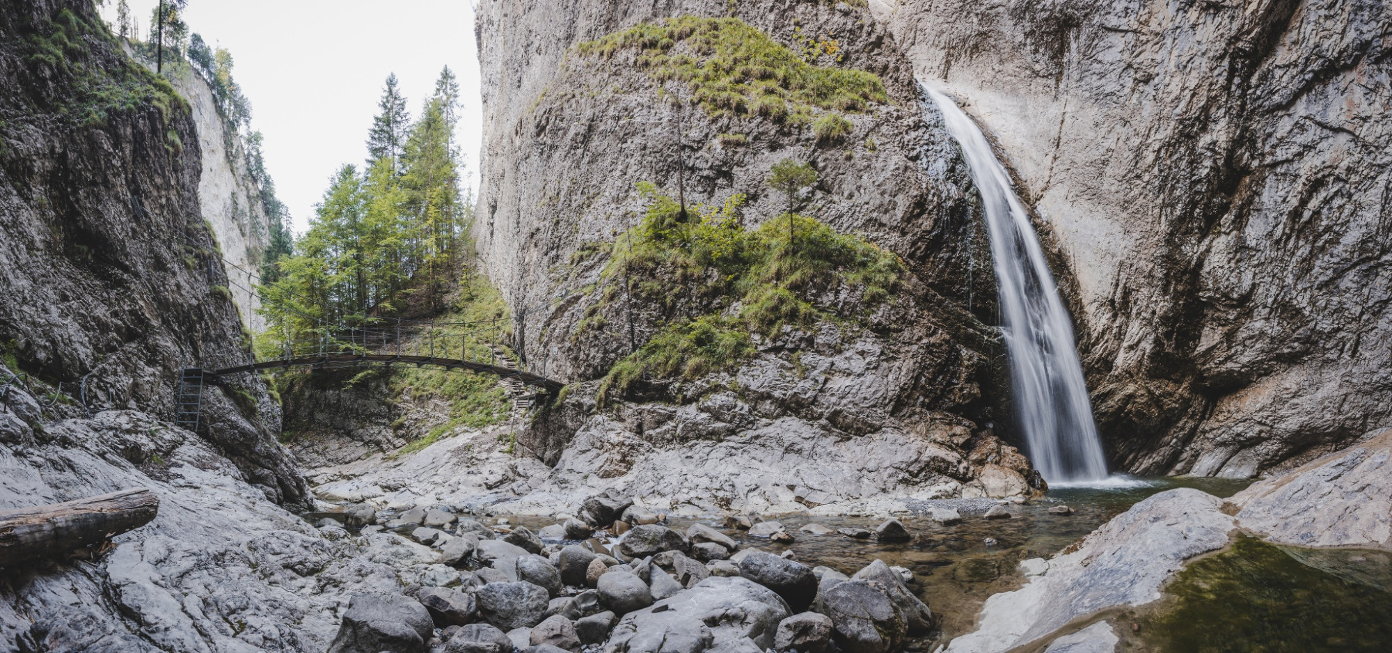
Continue back on the gravel path; soon the first viewing platform is reached, opening the view to a breathtaking water landscape, shaped by the Rotbach over centuries. A paradise for both geologists and nature lovers. Mertensia, cornflowers, woodland cranesbill and other colorful wildflowers line the way, and soon you come across a nice "Swiss Family" grill and picnic area. A view through the forest into the depths shows another grill place directly next to the river. Various hiking routes can be taken from here, but inevitably the famous waterfall Chessiloch attracts first; the signpost still shows 10 minutes from here. The path then continues somewhat adventurously over sticks and stones. After just a few minutes, there is a roaring, beautiful waterfall with a viewing platform above it. Wonderful natural power! But it goes even further uphill and soon the view falls on a wooden suspension bridge spanning the gorge. A deafening roar becomes louder and louder. At the end of the bridge comes the big wow. Magnificent the view of the Chessiloch waterfall, plunging noisily into the depths and spraying us with light mist.
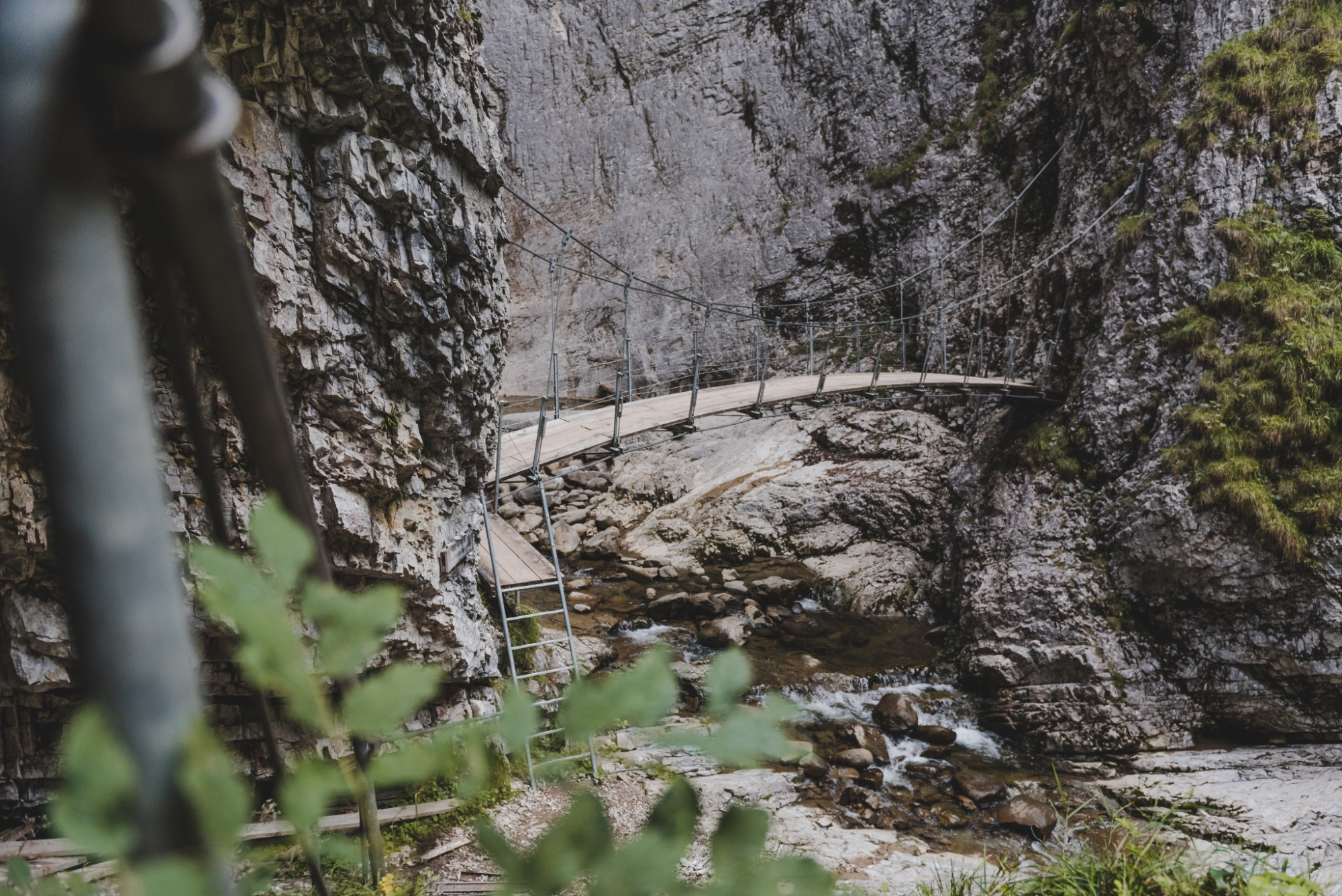
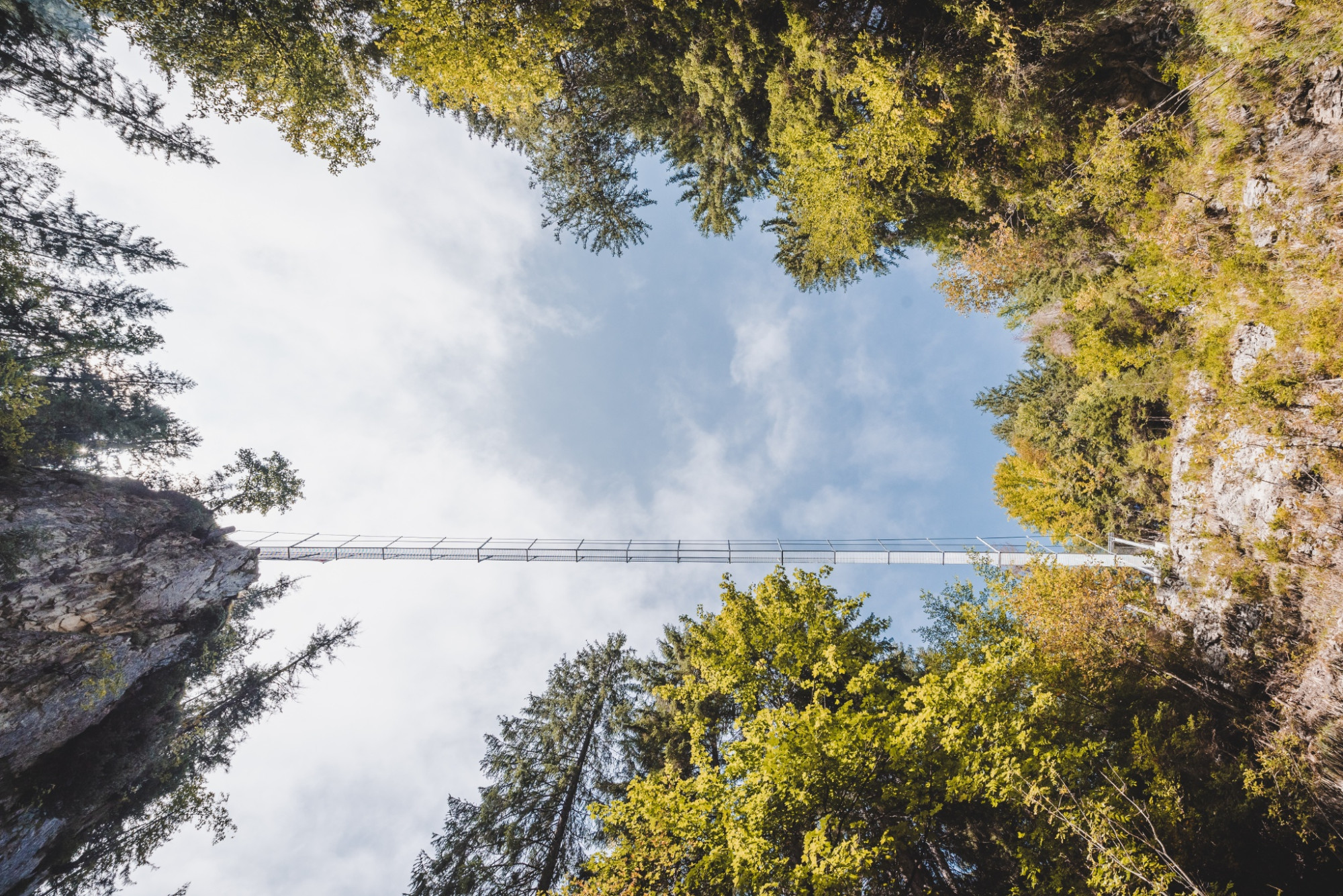
A souvenir photo is of course a must before returning along the same route to the fire pit. After all, a second highlight awaits on this route. From the rest area, a narrow path leads zigzag uphill. But after a short climb, it is quickly done, and you stand in front of the Chessimätteli suspension bridge. The bridge is 65 meters long and weighs about 7 tons. An impressive structure. But it takes a bit of courage here too to cross the bridge. On the first steps, it wobbles and the view falls into the deep Chessiloch gorge. Simply great, this view down into the valley-running gorge. On the other side of the bridge, numerous hiking trails start.
But for this circular route, you return again to the rest area and hike toward Kragen and Hüttlenen. After carefully crossing the main road, it goes on the Emme riverside path back to the village of Flühli. If the kids still have enough energy, there is still a water playground and other grill places here.
Route-information
Route-information
- Length
- 8.59 km
- Altitude difference ascent
- 259 m
- Altitude difference descent
- 259 m
- Time required
- 2 hours 35 minutes
- Level technique
- Easy
- Level condition
- Middle
Details
Sörenberg Flühli Tourism
Rothornstrasse 21
CH-6174 Sörenberg
Phone +41 (0)41 488 11 85
www.soerenberg.ch
Equipment / Equipment rent
Good footwear, rain jacket & sufficient drinking water on the way belong to every hike.
More tips for safe hiking, information about suckler cow herds and livestock guardian dogs and much more can be found on the website of Swiss Hiking Routes.
Safety advices
Information on the current condition of the hiking trail network of Sörenberg-Flühli can be found daily on the panoramic hiking map.
Signalization
Village, Flühli - Schlund - Kneipp facility Schwandalpweiher - Schwandalp - Chrageberg - Kragen - Chessiloch - Kragen - Hüttlenen - Village, Flühli
Arrival
Arrival
- Starting point
- Flühli
- Destination
- Chessiloch
Suitable for
The offer is suitable for
- Adults
- Children < 6 years
- Children from 7-12 years
- Children >12 years
- 50+
- Families
- Groups
Season
April, Mai, June, July, August, September, OctoberContact
UNESCO Biosphäre EntlebuchBiosphärenzentrum UNESCO Biosphäre Entlebuch
Chlosterbüel 28
6170 Schüpfheim
T +41 41 485 42 50
www.biosphaere.ch