UNESCO Biosphäre Entlebuch
Luftseilbahn Brienzer Rothorn
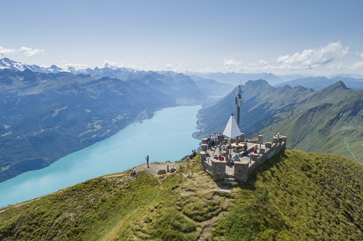
Auf das Brienzer Rothorn, den höchsten Punkt des Kantons Luzern, gelangen Sie bequem in weniger als 10 Minuten mit der Luftseilbahn.
Infrastructure SummerInfrastructure WinterFunicular
Swiss Parks Network
Monbijoustrasse 61
CH-3007 Berne
Tel. +41 (0)31 381 10 71
Mob. +41 (0)76 525 49 44
info@parks.swiss

UNESCO Biosphäre Entlebuch - The first stage of the Emmenuferweg invites you to marvel. The start at the Brienzer Rothorn is spectacular. Accompanied by impressive views of Lake Brienz and the Bernese Alps, the route leads to the source of the Emme and immerses into the UNESCO Entlebuch Biosphere.
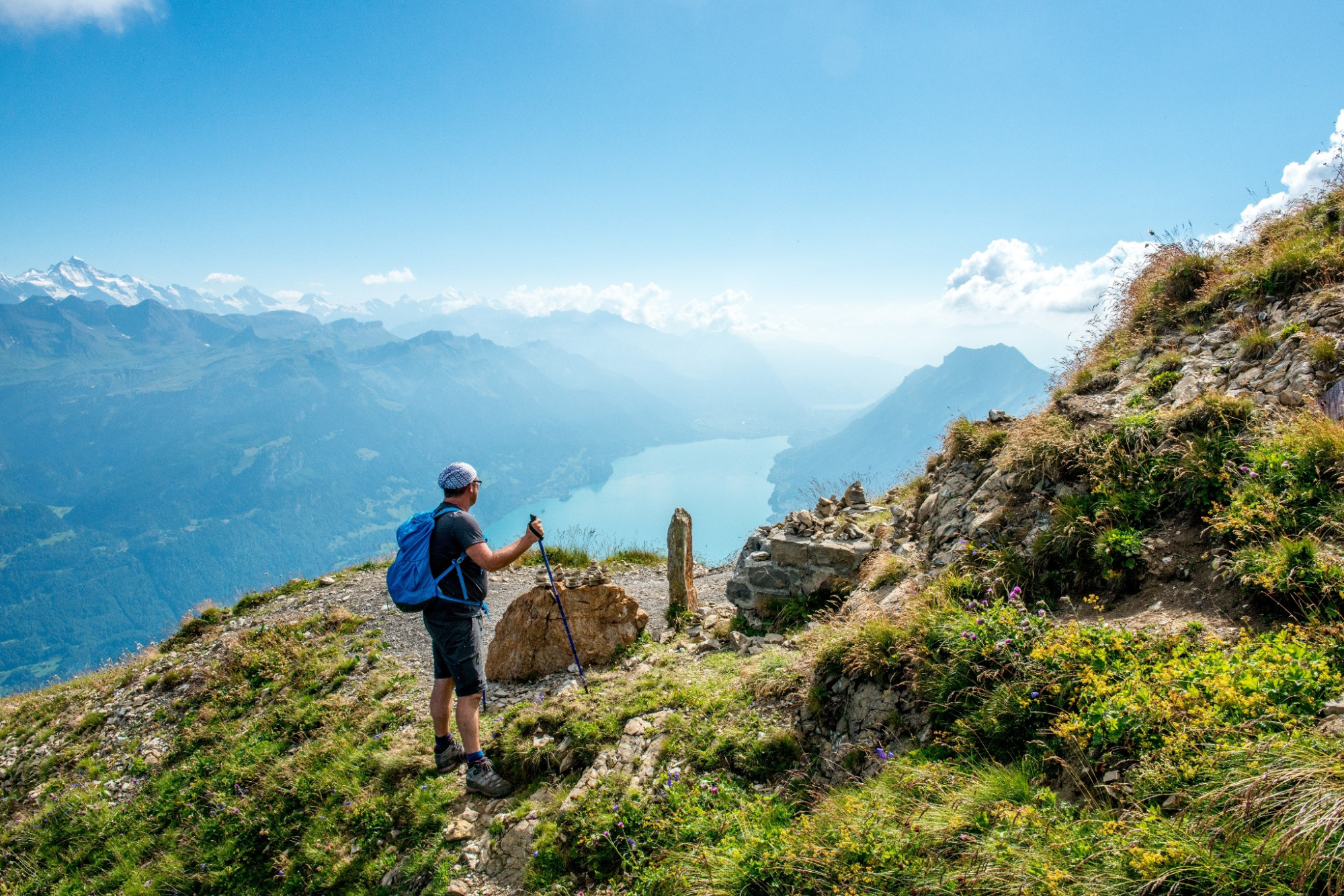
The hike begins with great views – on the highest peak of the canton of Lucerne, the Brienzer Rothorn. Once at the top, it is worth pausing for a moment and taking in the panorama. The view stretches north over the Waldemmental. In clear weather, the view extends over the Napf and the lakes beyond to the Black Forest. On the other side, Lake Brienz glistens in the depths, above which the snow-covered peaks of Eiger, Mönch, Jungfrau, and up to 690 other mountain peaks tower.
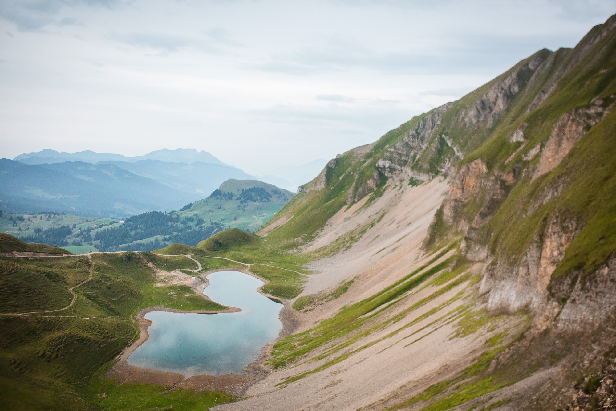
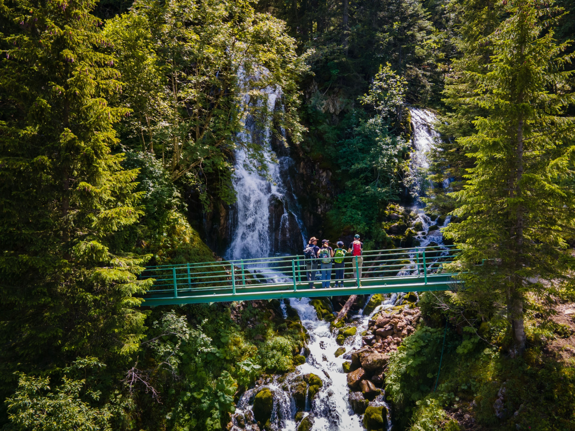
Past the viewpoint begins the descent towards Eisee. The small mountain lake lies at the foot of the Arnihaaggen, embedded in a mosaic of scree slopes and green meadows. The lakeshore invites for a first break. Those who dare can cool their feet in the icy cold mountain lake before tackling the descent towards Emmensprung. The path snakes further downhill in several switchbacks until the Emmensprung is reached at 1465 m altitude. As if from nowhere, the spring water bubbles out of the ground and finds its way into the valley, where it finally flows into the Waldemme. Just a few meters further, you will discover two waterfalls in the middle of a small forest, where water gushes down moss-covered rocks.
Over gentle meadows, the route follows the branched streams into the valley. On the descent, you immerse yourself in the UNESCO Entlebuch Biosphere with its unique river and moor landscapes, cozy floodplain forests, and scattered settlements. From the valley station of the aerial cableway, you can look forward to the comfortable part of the stage. Without major ascents or descents, the hiking trail leads along the Waldemme to the village of Sörenberg.
UNESCO Entlebuch Biosphere
Biosphere Centre
Chlosterbüel 28
CH-6170 Schüpfheim
Telephone +41 (0)41 485 42 50
www.biosphaere.ch
Good footwear, a rain jacket, and enough drinking water for the journey are essential for every hike.
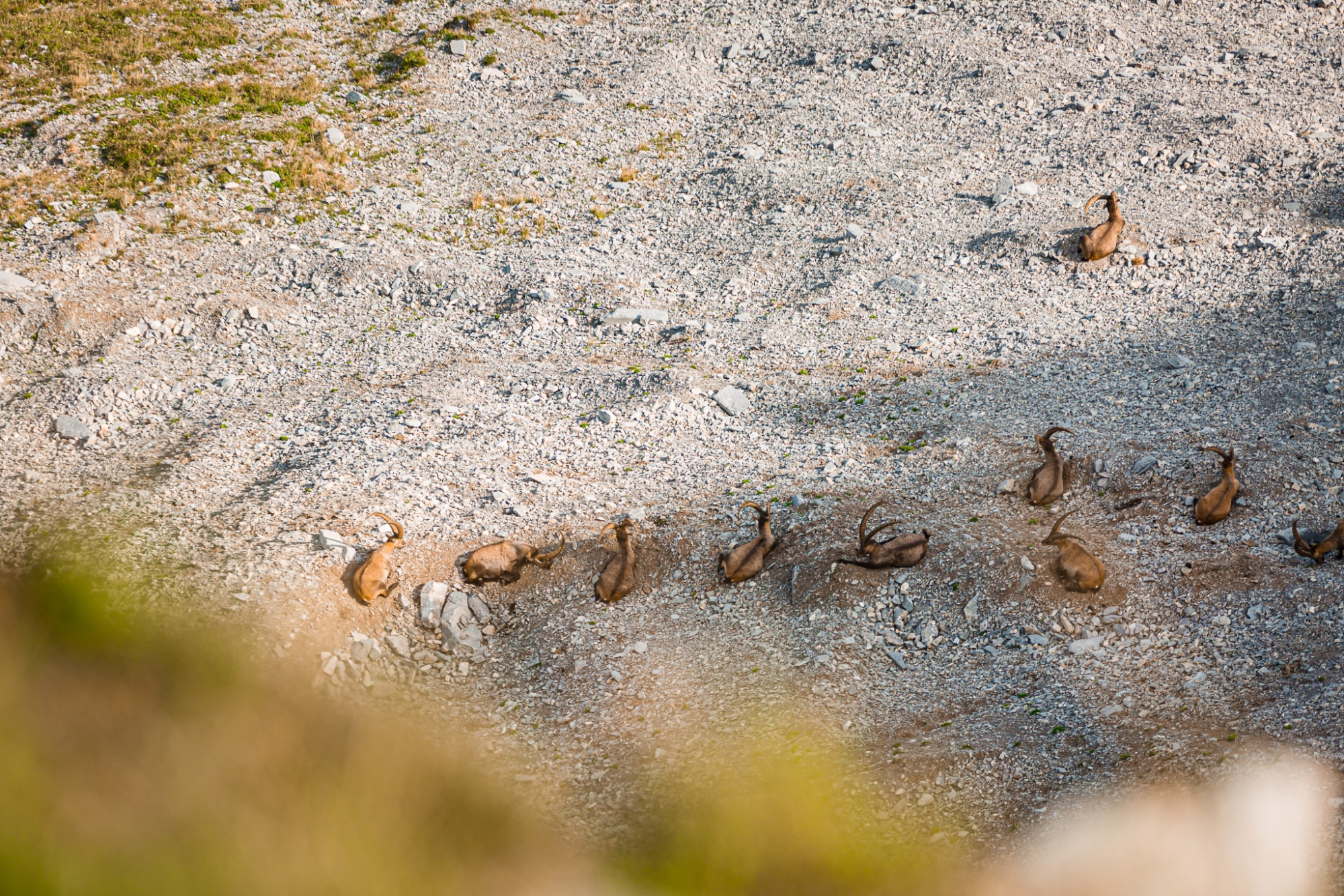
More tips for safe hiking, information about suckler cow herds and guardian dogs, and much more can be found on the website of Schweizer Wanderwege.
On high-altitude sections, snowfields are possible until the summer months.
Brienzer Rothorn - Eisee - Emmensprung - Sörenberg (village)
The entire route is marked with the signposts «83 Emmenuferweg».
Auf das Brienzer Rothorn, den höchsten Punkt des Kantons Luzern, gelangen Sie bequem in weniger als 10 Minuten mit der Luftseilbahn.
Geniessen Sie von der Gipfel-Terrasse oder im Restaurant mit Panoramafenstern die unglaubliche Aussicht.