


Glaubenbielen - Haglere - Sörenberg
UNESCO Biosphäre Entlebuch - Scenic hike through fantastic mountain and moor landscapes via Haglere to Sörenberg.
The hike starts at the parking lot on the Glaubenbielenplatz. Need provisions for the hiking route? At the entry to the hiking trail, there is a small alpine kiosk with fine cheese. After a short time, you also pass the Glaubenbielen alpine farm, in case you need a coffee or a small refreshment for the first ascent; after that, there are no more restaurants on this route.
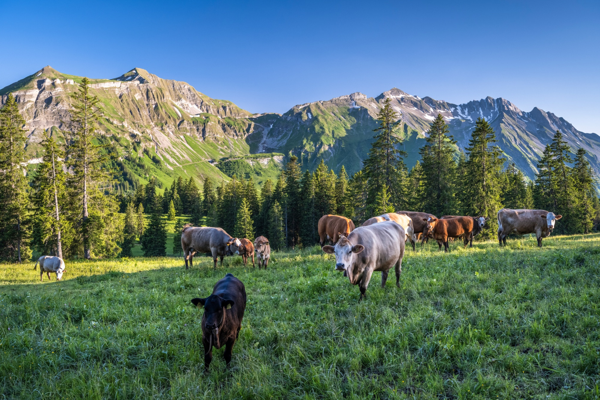
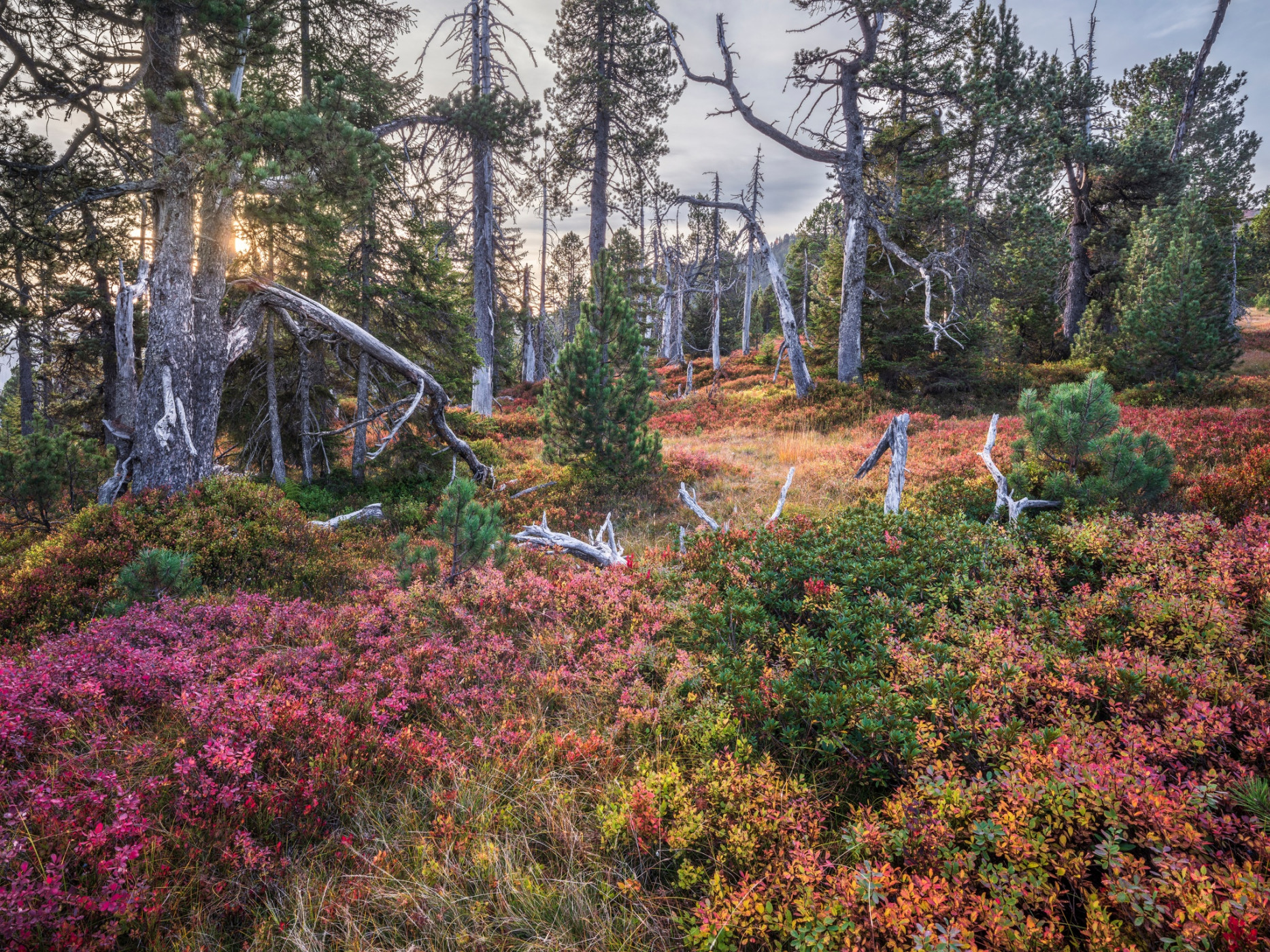
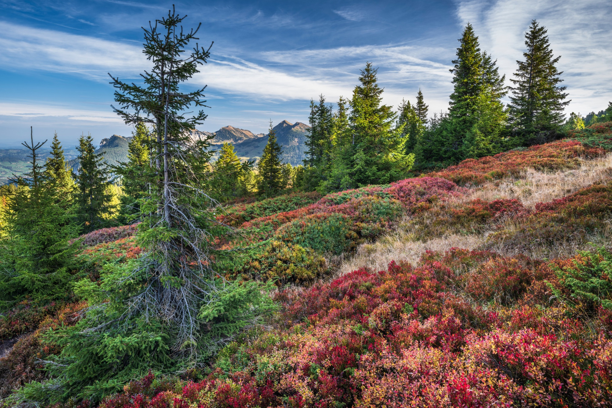
Soon the tougher part of the route begins, and the ascent towards Rotspitz starts. The fantastic view of the Brienzer Rothorn and the Schrattenfluh on one side and the Pilatus, Stanserhorn, and Rigi on the other side accompany you for a long time on this route. You then climb Nünalpstock and finally Haglere at 1948 m above sea level. At the summit cross, a break is well deserved. Watch out for dead trunk and root remains of mountain pines along the way. Perhaps a lizard is sunbathing there? Moor lizards are typical inhabitants of moor areas - Haglere is a nature reserve of Pro Natura. Did you know that well over a quarter of the UNESCO Biosphere Entlebuch area is covered with moorlands of national importance? Nowhere in Switzerland are there as many nationally protected moors in such a small area as in Entlebuch: 44 raised bogs, 61 low bogs, and 4 large moor landscapes shape our landscape.
For the descent towards Alpweid and Sörenberg, some leg strength is still required. The path first goes through the extensive terrain with a great view before you branch left onto the hiking trail towards Alpweid. After a short forest section, the hiking trail runs at times over open pastures. Take your time to admire the biodiversity along the path. At Alpweid, you switch from the hiking trail to the paved road and walk down into the village of Sörenberg.
Route-information
Route-information
- Length
- 9.78 km
- Altitude difference ascent
- 485 m
- Altitude difference descent
- 903 m
- Time required
- 3 hours 35 minutes
- Level technique
- Easy
- Level condition
- Middle
Details
Sörenberg Flühli Tourism
Rothornstrasse 21
CH-6174 Sörenberg
Phone +41 (0)41 488 11 85
www.soerenberg.ch
Equipment / Equipment rent
Good footwear, rain jacket & sufficient drinking water for the hike belong to every hike.
Further tips for safe hiking, information on cow-calf herds and guardian dogs, and much more can be found on the website of the Swiss Hiking Trails.
Safety advices
Information on the current condition of the Sörenberg-Flühli hiking trail network can be found daily on the panorama hiking map.
Signalization
Glaubenbielen Parking Lot - Rotspitz - Nünalpstock - Teufimattsattel - Haglere - Alpweid - Sörenberg
Arrival
Arrival
- Starting point
- Parkplatz Glaubenbielen
- Destination
- Sörenberg
Suitable for
The offer is suitable for
- Adults
- Children from 7-12 years
- Children >12 years
- 50+

Season
Mai, June, July, August, September, OctoberContact
UNESCO Biosphäre EntlebuchBiosphärenzentrum UNESCO Biosphäre Entlebuch
Chlosterbüel 28
6170 Schüpfheim
Tel. +41 41 485 42 50
www.biosphaere.ch