


Jeizi Enduro
Naturpark Pfyn-Finges - A technical enduro descent which, thanks to its sunny location, can be enjoyed from spring through autumn.
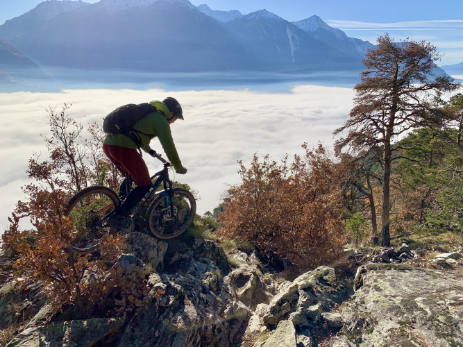
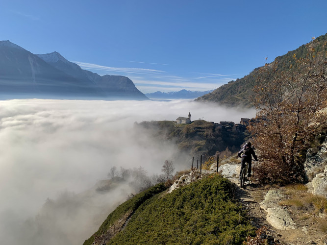
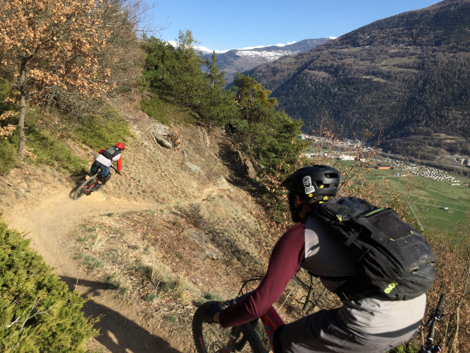
From Gampel, take the cable car to Jeizinen and start your adventure with a descent of around 900 metres. Ride along historic roads, then through the Furuwald forest, before reaching an old ruined building that you can pedal through. The route continues in the panoramic Pitschwald forest. Technically demanding passages over boulders and roots await you, while the view opens up over the valley. Once you have mastered these sections, take a short detour to the village of Bratsch and visit the "Rhone Terrace" observation platform near the church. The last section offers some technically challenging passages and a few hairpin bends, before continuing along the Jeizibärg path with its flowtrail. Enjoy a leisurely final stretch of your tour by following the path from Gampel to Jeizinen. Watch out, this trail is also used by many hikers.
Route-information
Route-information
- Length
- 9.70 km
- Amount untarred route
- 6.50 km
- Vertical heigth
- 891 m
- Altitude difference ascent
- 5 m
- Altitude difference descent
- 900 m
- Time required
- 45 minutes
- Level technique
- Hard
- Level condition
- Easy
Details
Safety advices
We recommend: a bike in excellent working order, a helmet, gloves and a bell, clothing suitable for the weather (always carry a waterproof), food and drink.Signalization
Use marked bike trails and routes only, making sure you observe all signposting. Kindly close gates after passing through. Please be considerate to walkers, as well as to plants and animals. As a rule, walkers have priority. When planning, take into account participants’ fitness level and ability. All riding is at one’s own risk.The route is signposted in one direction only:
Jeizinen - Obri Zälg - Bratsch - Gampel.
This route passes through a winter wildlife refuge area and therefore may not be used from December 15 to March 15.
Arrival
Arrival
- Starting point
- Bergstation Jeizinen (Altitude: 1507 m)
- Arrival by public transport
- Jeizinen (Bergstation) Timetable SBB
- Destination
- Gampel (Altitude: 626 m)
Suitable for
The offer is suitable for
- Adults
- 50+
Season
April, Mai, June, July, August, September, October, NovemberContact
My Leukerbad / Tourist InformationRathaus / Thermenstrasse 8
3954 Leukerbad
Tel. +41 (0)27 472 71 71
leukerbad.ch/