Navigating the Swiss parks network
Discover all offers

Swiss Parks Network
Monbijoustrasse 61
CH-3007 Berne

Tel. +41 (0)31 381 10 71
Mob. +41 (0)76 525 49 44
info@parks.swiss

Contact us

News from the parks

10th National Swiss Parks Market, 21 May 2026

On 21 May 2026, the Bundesplatz will transform into a festival of culinary delights. Taste the finest regional specialities from the Swiss parks and meet passionate producers! The programme includes tastings, games and activities for young and old, music – everything you need to enjoy for a great time. Save the date!

9th national Swiss parks market, 15th May 2025

Am Donnerstag, 15. Mai 2025, ist der Pärke-Markt zurück auf dem Bundesplatz in Bern. Auf dem Programm stehen Spezialitäten, Degustationen, Spiele und Mitmach-Aktivitäten an den Ständen, Musik und alles, was es braucht für eine gute Zeit. Reservieren Sie sich das Datum schon jetzt!
Show all

Moor Landscape Path Stage 5: Moor Landscape Glaubenberg

Hiking trail
Time required: 4 hours 40 minutesLength: 12.43 km

UNESCO Biosphäre Entlebuch - The last stage of the Moor Landscape Path leads you into the Hagleren nature reserve, through paths in wild and primeval landscapes with gorges, rockslide areas and a lake.

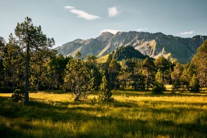
A hike with a marked ascent and descent through a primeval mountain pine raised bog on a long ridge with wide views of the Alps awaits you on this stage of the Moor Landscape Path.

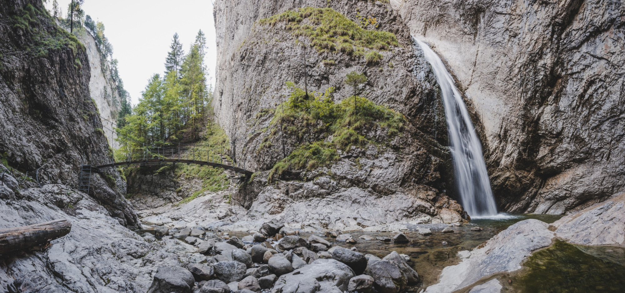
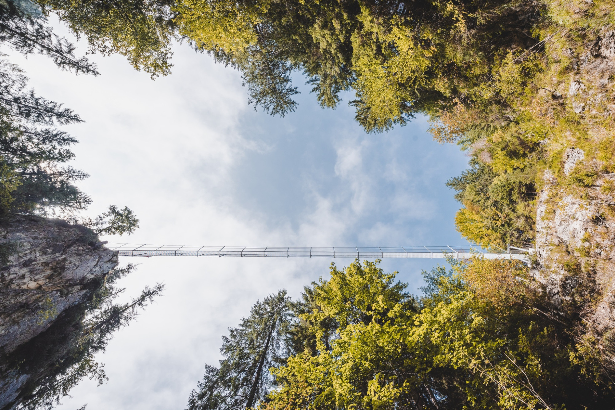
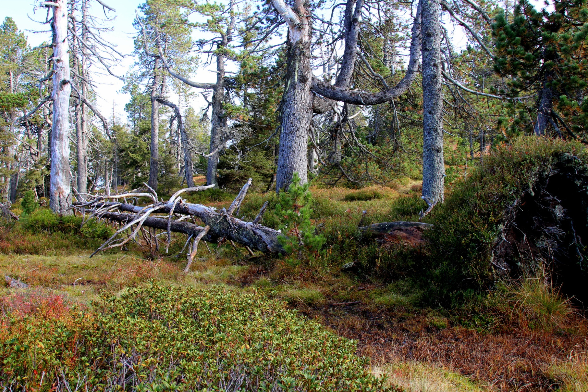
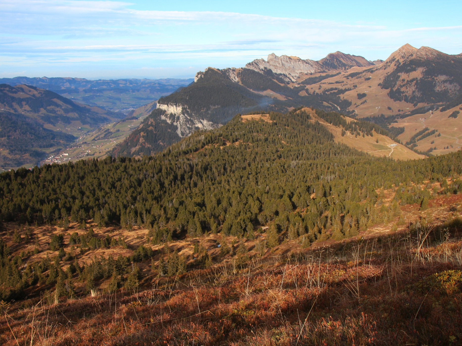
Special in the moor landscape is the Chessiloch with its impressive waterfall and suspension bridge. With the longest suspension bridge in Entlebuch, the hiking trail is ideally connected for a short detour. In Bleikebode, the species-rich fens are an eye-catcher as valued litter suppliers. And of course the Haglere (viewpoint) with the mountain pine raised bog forest, a 45-hectare nature reserve by Pro Natura. Here you walk through one of the largest and most beautiful raised bogs in the Entlebuch Biosphere. Take your time and observe the gnarled mountain pines. The dead trees provide food for many animal species. The path is soft, moist, and in many places the brown peat layer is exposed. Take off your shoes and socks here and walk barefoot for the next kilometer. A detour to the Haglere cross is highly recommended - the view is phenomenal, and also impressive is
the 700-meter long border wall.

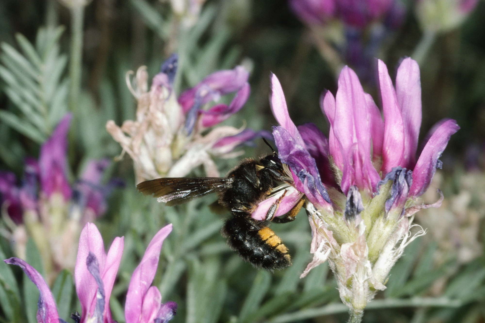
After the detour to Haglere, you head downhill. Here you encounter the last moorland of this stage, the Mittlist-Gfäl fen. Besides the typical fen plants such as orchids and cotton grasses, wild chives also grow along the path here. Try a small piece of the violet flowering plant and compare the taste with that of garden chives. Caution: a similarly looking, protected orchid also blooms here. In early autumn, the moor is cut with a light mountain mower and scythe.

Via Alpweid, you hike into the village of Sörenberg, the destination of the last stage. Here you deserve a cool beer, fresh iced tea, or a fine dessert!

Moor Landscape Path UNESCO Biosphere Entlebuch
Discover here all stages of the five-day adventure through the Entlebuch moor landscapes.

Package Offer
While you hike on the marked Moor Landscape Path, enjoy the fascinating natural landscapes and tastefully enjoy the packed lunch at the most beautiful spots, your luggage travels to the next overnight location. Here too, you enjoy a great variety – from overnight stays in a tipi on the alp to a 3-star hotel with a regional 4-course menu – and fall into a deep, restful sleep. Here is the package offer.

Route-information

Length
12.43 km
Altitude difference ascent
826 m
Altitude difference descent
1045 m
Time required
4 hours 40 minutes
Level technique
Easy
Level condition
Middle
Height profile view map

UNESCO Biosphere Entlebuch
Chlosterbüel 28
CH-6170 Schüpfheim
Tel. +41 (0)41 485 42 50
zentrum@biosphaere.ch
www.biosphaere.ch


Would you like to explore the moor with an expert? The UNESCO Biosphere Entlebuch is happy to organize guided hikes or excursions. Please inquire at the Biosphere Centre: zentrum@biosphaere.ch or Tel. +41 (0)41 485 42 50.


Equipment / Equipment rent

Good footwear and all-weather equipment are essential. Recommended are binoculars, plant and animal identification books, possibly also a towel to dry your feet after barefoot walking.

Safety advices

Mobile reception is partially difficult to impossible.

Signalization

  • Stäldili - Gitziloch - Bleikechopf - DäleBode - Alpweid - Sörenberg Post
  • The route is marked with the sign "Moor Landscape Path" and can also be walked in the opposite direction.
  • The stages "Habkern/Sörenberg" or "Glaubenberg (Stage 1)" can be linked to this route.

Variants

Ascent from Flühli to Gitziloch: 2h, 410m ascent

Descent from Gitziloch to Flühli: 1h30, 410m descent

Ascent & descent DäleBode-Haglere: 40 min, 140m ascent/descent

Arrival

Starting point
Flühli, Alprestaurant Stäldeli
Destination
Sörenberg, Postautohaltestelle Sörenberg, Post

The offer is suitable for

  • Adults
  • 50+
UNESCO Biosphäre Entlebuch  

Moorlandschaftspfad – Wanderpauschalangebot

Während fünf Tagen durchwandern Sie die grösste Moorlandschaft der Schweiz: Die vielfältigen und intakten Flach- und Hochmoore betten sich lieblich in die Entlebucher Moorlandschaften von nationaler Bedeutung.

Nature experience

Season

Mai, June, July, August, September, October

Contact

UNESCO Biosphäre Entlebuch  
Biosphärenzentrum UNESCO Biosphäre Entlebuch
Chlosterbüel 28
6170 Schüpfheim
T +41 41 485 42 50

www.biosphaere.ch

Map