Jurapark Aargau
Kienberg hiking trails - Route 4
Route 4 of the Kienberg hiking trails impresses with the Burgflue viewpoint, a visit to the Heidegg ruins, and a hike through the nature reserve in the old gypsum quarry.
Hiking trail
Time required: 2 hours 10 minutesLength: 7.30km
Jurapark Aargau
Kienberg hiking trails - Route 5
Route 5 of the Kienberg hiking routes connects natural gems and cultural treasures around Kienberg: a viewpoint, two ruins, and an old gypsum quarry await you.
Hiking trail
Time required: 3 hours 38 minutesLength: 12.16km
Naturpark Thal
Königstour - Juraweg Thal
Wandern Sie von Gänsbrunnen nach Balsthal auf der zweiten Jurakette dem Juraweg Thal entlang. Informationstafeln vermitteln Wissenswertes zur Region Thal. Reine Wanderzeit von Gänsbrunnen bis Balsthal oder umgekehrt: 7,5 Stunden.
Hiking trail
Time required: 7 hours 30 minutesLength: 25.00km
Parc naturel régional Gruyère Pays-d'Enhaut
L'Etivaz - Col des Mosses
From the hamlet of L'Etivaz to the pre-Alpine resort of Les Mosses, this stage offers a panoramic view of the Pra Cornet plateau and the Vanils chain. The path allows you to appreciate the Lioson lake, before descending to the Mosses pass.
Hiking trail
Time required: 5 hoursLength: 14.00km
Parc naturel régional Gruyère Pays-d'Enhaut
L'Etivaz - Les Moulins
The walk begins at the storage cellars of L’Etivaz, where all the Etivaz AOP cheeses mature. Les Moulins is reached over diverse cow meadows belonging to the alpine farms, of which some produce Etivaz AOP.
Theme trailHiking trailOther routes
Time required: 2 hours 15 minutesLength: 7.50km
Parc naturel régional Jura vaudois
La Grande Traversée - Stage 1
From Saint-Cergue, the trail leads through typical Jura wooden pastures before reaching the Marchairuz pass. You might even run into some wood ants, Jura Vaudois Nature Park's symbol.
Hiking trail
Time required: 5 hoursLength: 17.00km
Parc naturel régional Jura vaudois
La Grande Traversée - Stage 2
From the Marchairuz pass, the trail follows the Jura crest to its highest point, the Mont Tendre (1679m) which offers an outstanding view. You then go back down to Montricher.
Hiking trail
Time required: 5 hoursLength: 15.50km
Parc naturel régional Jura vaudois
La Grande Traversée - Stage 3
From Montricher, the trail continues along the foot of the Jura and its authentic villages offering beautiful views on the Alps. La Grande Traversée ends at Romainmôtier, a medieval town famous for its abbey.
Hiking trail
Time required: 4 hoursLength: 17.00km
Parc naturel régional Jura vaudois
La Grande Traversée Hiking
Enjoy fabulous views, typical forests and wooded pastures along the Jura Crest trail. After the climb to the Mont Tendre (1679 m), the route leads down the Pied du Jura foothills through typical villages.
Hiking trail
Time required: 15 hoursLength: 48.50km
Parc naturel régional Gruyère Pays-d'Enhaut
La Sarine au Pays-d'Enhaut
From Rougemont, which was once the priory of Cluny, the trial goes over the Kirchenhügel from Château-d'Oex to the Grand Chalet of Rossinière. It goes between the rushing Saane and landscape steeped in history, moulded by the mountain farmers.
Hiking trail
Time required: 2 hoursLength: 15.00km
Parc naturel régional Gruyère Pays-d'Enhaut
La Tine - Allières
The route ascends an alpine road up to the mountain ridge underneath La Petite Chia Alp. From there the trail descends to Montbovon and the the Hongrin valley, an essential passageway for the Gruyère and Pays-d’Enhaut alpine farmers.
Theme trailHiking trailOther routes
Time required: 2 hours 45 minutesLength: 7.90km
Parc naturel régional Gruyère Pays-d'Enhaut
La Valsainte – Charmey
A gentle stroll through the Javro valley
Hiking trail
Time required: 2 hours 5 minutesLength: 7.30km
Naturpark Pfyn-Finges
Lämmern Glacier Trail
Gemmi Pass - Lämmerenboden: a pasture landscape of national importance
Hiking trail
Time required: 4 hours 30 minutesLength: 11.20km
Naturpark Pfyn-Finges
Land of Waterfalls
Hamlet of Colombire (Montana) - Tsittoret irrigation channel - Valley of Tièche - ColombireEcological Museum Colombire - Tsittoret irrigation channel (Suone) - Waterfalls
Hiking trail
Length: 6.00km
Wildnispark Zürich Sihlwald
Langenberg–Türlen
Easy hike up to the Albis Ridge and then down to the Türler Lake
Hiking trail
Time required: 2 hours 15 minutesLength: 7.30km
Wildnispark Zürich Sihlwald
Langnau am Albis – Langrainhütte – Langnau am Albis
Diese abwechslungsreiche Rundwanderung von Langnau am Albis in den Naturwald Sihlwald und wieder zurück verspricht eine tolle Aussicht in die Ferne sowie einen spannenden Einblick in die Waldwildnis.
Hiking trail
Time required: 3 hoursLength: 9.70km
Parc naturel régional Gruyère Pays-d'Enhaut
Le Col des Mosses – Rossinière
From the Col des Mosses, the hiking trail cross over streams and through forests to Les Monts Chevreuils. Along the way there are several breathtaking views, such as the Sarine Valley, Château-d’Œx and Les Vanils mountain range.
Hiking trail
Time required: 4 hours 45 minutesLength: 15.50km
Parc du Doubs
Le sentier de la réserve forestière du Theusseret
Nichée dans les côtes du Doubs, sur les communes de Saignelégier, Muriaux et le Noirmont, la Réserve forestière du Theusseret s’étend sur 128 hectares et protège une forêt très diversifiée.
Hiking trail
Time required: 1 hour 15 minutesLength: 4.00km
Parc naturel régional Jura vaudois
Les 7 balades de Vaulion
Au départ du village de Vaulion, situé dans le Vallon du Nozon, 7 balades sont proposées aux randonneurs. D'une durée allant de 45 minutes à plus de 4h de marche, elles proposent des parcours faciles et des itinéraires pour marcheurs aguerris.
Hiking trail
Parc naturel régional Gruyère Pays-d'Enhaut
Les Avants – Montreux
From tranquil mountain pastures to tumultuous waterfalls.
The Chauderon gorges are closed until further notice.
Hiking trail
Time required: 2 hours 55 minutesLength: 9.10km
Hint
Parc du Doubs
Les Chemins de la contrebande franco-suisse
Glissez-vous dans la peau d’un contrebandier sur l’un des quatre chemins de la contrebande et profitez de sites naturels totalement préservés.
Theme trailHiking trail
Time required: 11 hoursLength: 78.00km
Parc naturel régional Gruyère Pays-d'Enhaut
Les Combes – Château-d’Œx
Partially open
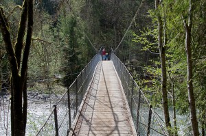
Starting in Les Combes, the trail leads over meadows and pastures down to the Saane river and crosses it. The trial then goes over an old suspension bridge before one arrives in the village centre of Château-d'Oex.
Theme trailHiking trailOther routes
Time required: 1 hour 15 minutesLength: 4.80km
Parc naturel régional Gruyère Pays-d'Enhaut
Les Granges-Gérignoz – L'Etivaz
La Pierreuse, green pastures, and limestone slopes
Hiking trail
Time required: 4 hours 45 minutesLength: 10.60km
Parc naturel régional Gruyère Pays-d'Enhaut
Les Moulins - Rossinière
The walk goes over pastures on the floor of Les Moulins valley to the bank of the River Saane. It continues to the old transit road, that in former day connected the Riviera or the Gruyère country with the Pays-d’Enhaut and Saanenland.
Theme trailHiking trailOther routes
Time required: 1 hour 15 minutesLength: 4.80km
Parc régional Chasseral
Les Prés-d'Orvin – Chasseral
A relatively gentle but continuous uphill hike from Les Prés-d'Orvin to the summit of the Chasseral following the ridge and through typical forests and wooded pastures. Panoramic views, alpine flora and the Chasseral antenna are on the menu.
Hiking trail
Time required: 3 hours 30 minutesLength: 12.00km
Parc naturel régional Gruyère Pays-d'Enhaut
Lessoc - Montbovon
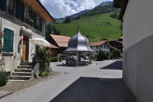
Starting at the Lessoc well (1796), whose cupola was a gift of a cheese merchant from Lyon, the trail leads to Montbovon.
Theme trailHiking trailOther routes
Time required: 1 hourLength: 3.40km
Naturpark Pfyn-Finges
Leukerbad - Gemmi Pass
The mule track was constructed by the Tyroleans in 1739/41 and leads through the Daubenwand, which even today seems insurmountable, and up to the Gemmi Pass. With a bit of luck you might see bearded vultures.
Hiking trail
Time required: 3 hoursLength: 4.70km
Naturpark Pfyn-Finges
Leukerfeld, Feschelloch
Pleasant pine and mixed deciduous and coniferous grove and the hidden Feschelloch
Theme trailHiking trail
Time required: 30 minutesLength: 1.50km
UNESCO Biosphäre Entlebuch
Main route | Entlebuch Energy Experience
Experience energy - and recharge your batteries
The unique adventure trail on the subject of renewable energies is located in the heart of the UNESCO Entlebuch Biosphere. The routes lead through varied landscapes between Entlebuch and Finsterwald, partly along the wild Entlen, through forests and past moors.
www.erlebnisenergie.ch
Hiking trail
Time required: 4 hours 15 minutesLength: 13.66km
Jurapark Aargau
Mandach Bench Circular Route
Two-hour circular route around Mandach with wonderful views and benches to rest.
Hiking trail
Time required: 2 hours 31 minutesLength: 9.78km